Rivers of Bangladesh

Brahmaputra River
The Brahmaputra (/ˌbrɑːməˈpuːtrə/ is
one of the major rivers of Asia, a trans-boundary river which flows
through China, India and Bangladesh. As such, it is known by various names in
the region: Assamese: ব্ৰহ্মপুত্ৰ নদ ('নদ' nôd,
masculine form of 'নদী' nôdi "river") Brôhmôputrô [bɹɔɦmɔputɹɔ]; Sanskrit: ब्रह्मपुत्र, IAST: Brahmaputra; Tibetan: ཡར་ཀླུངས་གཙང་པོ་, Wylie: yar klung
gtsang po Yarlung Tsangpo; simplified Chinese: 布拉马普特拉河; traditional Chinese: 布拉馬普特拉河; pinyin: Bùlāmǎpǔtèlā
Hé. It is also called Tsangpo-Brahmaputra (when referring to the whole
river including the stretch within Tibet). The Manas River, which
runs through Bhutan, joins it at Jogighopa, in India. It is the
tenth largest river in the world by discharge, and the 15th longest.

With its origin in the Angsi glacier, located on the
northern side of the Himalayas in Burang County of Tibet as
the Yarlung Tsangpo River,it flows across southern Tibet to
break through the Himalayas in great gorges (including the Yarlung Tsangpo
Grand Canyon) and into Arunachal Pradesh (India).It flows southwest
through the Assam Valley as Brahmaputra and south through Bangladesh as
the Jamuna (not to be mistaken with Yamuna of India). In
the vast Ganges Delta, it merges with the Padma, the popular name of
the river Ganges in Bangladesh, and finally the Meghna and
from here it is known as Meghna before emptying into the Bay of Bengal.
About 3,848 km (2,391 mi) long, the
Brahmaputra is an important river for irrigation and transportation.
The average depth of the river is 38 m (124 ft) and maximum depth is
120 m (380 ft). The river is prone to catastrophic flooding in the
spring when Himalayas snow melts. The average discharge of the river is about
19,800 m3/s (700,000 cu ft/s),and
floods can reach over 100,000 m3/s
(3,500,000 cu ft/s). It is a classic example of a braided
river and is highly susceptible to channel migration and avulsion.It
is also one of the few rivers in the world that exhibit a tidal bore. It
is navigable for most of its length.
The river drains the Himalaya east of the Indo-Nepal border,
south-central portion of the Tibetan plateau above the Gangabasin,
south-eastern portion of Tibet, the Patkai-Bum hills, the northern slopes
of the Meghalaya hills, the Assam plains, and the northern portion of
Bangladesh. The basin, especially south of Tibet, is characterized by high
levels of rainfall. Kangchenjunga (8,586 m) is the only peak above
8,000 m, hence is the highest point within the Brahmaputra basin.
The Brahmaputra's upper course was long unknown, and its
identity with the Yarlung Tsangpo was only established by exploration in
1884–86. This river is often called Tsangpo-Brahmaputra river.
Padma River
The Padma (Bengali: পদ্মা Pôdda) is a major river in Bangladesh. It is the main distributary of the Ganges,
flowing generally southeast for 120 kilometres (75 mi) to its confluence
with the Meghna River near the Bay of Bengal.The city of Rajshahi is
situated on the banks of the river.
History
Etymology
The Padma, Sanskrit for lotus
flower, is mentioned
in Hindu mythology as a byname for the Goddess Lakshmi.
The name Padma is given to the lower part of
the course of the Ganges (Ganga) below the point of the off-take of the Bhagirathi
River(India), another
Ganges River distributary also known as the Hooghly
River. Padma had, most
probably, flowed through a number of channels at different times. Some authors
contend that each distributary of the Ganges in its deltaic part is a remnant
of an old principal channel, and that starting from the western-most one, the
Bhagirathi (in West Bengal, India), each distributary to the east marks a
position of a newer channel than the one to the west of it.
Geographic effects

Padma River and boats (1860)
Eighteenth-century geographer James
Rennell referred to a
former course of the Ganges north of its present channel, as follows:
Appearances favour very strongly that the Ganges had its former
bed in the tract now occupied by the lakes and morasses between Natore and
Jaffiergunge, striking out of the present course by Bauleah to a junction of
Burrrampooter or Megna near Fringybazar, where accumulation of two such mighty
streams probably scooped out the present amazing bed of the Megna.
The places mentioned by Rennell proceeding from west to east
are Rampur Boali, the headquarters
of Rajshahi district, Puthia and Natore in
the same district and Jaffarganj in the district of Dhaka. The place last named were shown in a map of
the Mymensinghdistrict
dated 1861, as a subdistrict (thana) headquarters, about 10 kilometres
(6 mi) south-east of Bera Upazila police
station. It is now known as Payla Jaffarganj and is close to Elachipur
opposite Goalunda. According to Rennell's theory,
therefore, the probable former course of the Ganges would correspond with that
of the present channel of the Baral River.
Authorities agree that the Ganges has changed its course and
that at different times, each of the distributaries might have been the carrier
of its main stream.
The bed of the Padma is wide, and the river is split up into
several channels flowing between constantly shifting sand banks and islands.
During the rains the current is very strong and even steamers may find
difficulty in making headway against it. It is navigable at all seasons of the
year by steamers and country boats of all sizes and until recently ranked as
one of the most frequented waterways in the world. It is spanned near Paksey by
the great Hardinge Bridge over which runs one of the
main lines of the Bangladesh Railway.

Hardinge Bridge in Bangladesh
Geography
The Padma enters Bangladesh from India near Nawabganj and meets the Jamuna (Bengali: যমুনা Jomuna)
near Aricha and retains its name, but finally meets with the Meghna (Bengali: মেঘনা) near Chandpur and
adopts the name "Meghna" before flowing into the Bay
of Bengal.
Rajshahi, a major city in western Bangladesh, is
situated on the north bank of the Padma.
The Ganges originates in the Gangotri Glacier
of the Himalaya, and runs through India and Bangladesh to the Bay of Bengal.
The Ganges enters Bangladesh at Shibganj in the district of Chapai Nababganj.
West of Shibganj, the Ganges branches into two distributaries, the Bhagirathi and the Padma rivers. The Bhagirathi
River, which flows southwards, is also known as the Ganga and was named the
Hoogly or Hooghly River by the British.
Further downstream, in Goalando, 2,200 kilometres
(1,400 mi) from the source, the Padma is joined by the Jamuna (Lower Brahmaputra) and the resulting combination flows with the
name Padma further east, to Chandpur. Here, the widest river in Bangladesh, the
Meghna joins the Padma, continuing as the Meghna almost in a straight line to
the south, ending in the Bay of Bengal.

Sunset from Padma River
Pabna District

A view of Padma river in summer near Rajshahi
The Padma forms the whole of the southern boundary of the Pabna District for
a distance of about 120 kilometres (75 mi).
Kushtia District
The Jalangi River is thrown off at the point
where the mighty Padma touches the district at its most northernly corner, and
flows along the northern border in a direction slightly southeast, until it
leaves the district some miles to the east of Kushtia. It carries immense volumes of water and is
very wide at places, constantly shifting its main channel, eroding vast areas
on one bank, throwing chars on the other, giving rise to many disputes as to
the possession of the chars and islands which are thrown up.
Rajshahi District
Rajshahi is the largest city among the cities which is situated
on the bank of Padma river. It is the third largest city in Bangladesh. It is a
major city in the north Bengal. Rajshahi has a beautifully decorated embankment
of Padma. Rajshahi Collegiate School is one of the oldest schools in Indian
Subcontinent, situated on Padma river bank. The school was endangered three
times by the disintegration of the Padma river. Padma Food Garden, A.H.M.
Kamaruzzaman Central Park and Zoo, Barokuthi Nandan Park, Muktamancha, and 'T'
shaped embankment (Bengali: টি বাঁধ) are best tourist spot in Rajshahi which are
situared on the bank of Padma river.
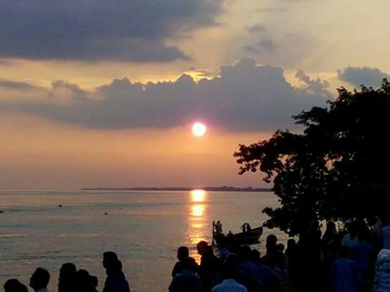
Sunset from the river Padma during monsoon,
Rajpara, Rajshahi
Infrastructure

Sky over river padma
Damming
After the construction of the Farakka Barrage on
the Ganges River in West
Bengal, the maximum flows in
the Padma River were reduced significantly. The flow reduction caused many
problems in Bangladesh, including the loss of fish species, the drying of
Padma's distributaries, increased saltwater intrusion from the Bay of Bengal,
and damage to the mangrove forests of the Sundarbans.
Padma Bridge
The Padma
Bridge would be
Bangladesh's largest, estimated at US$2.3 billion to finish. It was supposed to
be open to the public in 2013. However, the future of the project became
uncertain when in June 2012 the World
Bank cancelled its
$1.2 billion loan over corruption allegations. In June 2014, the government of
Bangladesh, proceeding without the loan, hired a Chinese firm to construct the
6.15-kilometre (3.82 mi) main part of the bridge, and in October 2014, it
hired a South Korean firm to supervise construction. Officials aim to finish
the project by 2018.In 2009, government plans also included
rail lines on both sides of the Padma with a connection via the new bridge.

Lalon Shah Bridge, also
known as the Paksey Bridge, is a road bridge in Bangladesh over the river
Padma, situated between Ishwardi Upazila of Pabna on the east, and Bheramara
Upazila of Kushtia on the west.
Ganges
The Ganges (/ˈɡændʒiːz/ GAN-jeez), also known
as Ganga (Hindustani: [ˈɡəŋɡaː]), is a trans-boundary river of Asia which
flows through the nations of India and Bangladesh. The
2,525 km (1,569 mi) river rises in the eastern Himalayas in
the Indian state of Uttarakhand, and flows south and east through
the Gangetic Plain of North
India. After entering West Bengal, it is divided into two rivers, one
is Hugly river or Adi Ganga, flowing through several districts of West Bengal
and finally submerged with Bay of Bengal near Ganga
Sagar. The second part is named as Padma which
flows into Bangladesh, where it empties into the Bay of
Bengal. It is the third largest river in the world by discharge.
The Ganges is one of the most sacred rivers to Hindus,
although it is not mentioned in either the Rigveda or
the Ramayana.It is also a lifeline to millions of Indians
who live along its course and depend on it for their daily needs. It is
worshipped as the goddess Ganga in Hinduism.It has also been important historically,
with many former provincial or imperial capitals (such as Kannauj, Kampilya, Kara, Prayag or Allahabad, Kashi, Pataliputra or Patna, Hajipur, Munger, Bhagalpur, Murshidabad, Baharampur, Nabadwip, Saptagram, Kolkata and Dhaka) located
on its banks.
The Ganges is highly polluted. Pollution threatens not only
humans, but also more than 140 fish species, 90 amphibian species and the
endangered Ganges river dolphin. The levels of fecal
coliform from human waste in the waters of the river near Varanasi are
more than 100 times the Indian government's official limit. The Ganga
Action Plan, an environmental initiative to clean up the river, has been a
major failure thus far, due to corruption, technical expertise, poor
environmental planning,and lack of support from religious authorities.
Geology
The Indian subcontinent lies atop the Indian
tectonic plate, a minor plate within the Indo-Australian Plate. Its defining geological
processes commenced seventy-five million years ago, when, as a part of the
southern supercontinent Gondwana, it began a
northeastwards drift—lasting
fifty million years—across the then unformed Indian Ocean. The
subcontinent's subsequent collision with the Eurasian
Plate and subductionunder it,
gave rise to the Himalayas, the planet's highest mountain
ranges. In the former seabed immediately south of the emerging Himalayas,
plate movement created a vast trough, which,
having gradually been filled with sediment borne by the Indus and
its tributaries and the Ganges and its tributaries, now forms the Indo-Gangetic Plain.
Hydrology

A 1908 map
showing the course of the Ganges and its tributaries.

Catchment
region of the Ganga
Major
left-bank tributaries include Gomti (Gumti), Ghaghara
(Gogra), Gandaki (Gandak),
and Kosi (Kusi); major right-bank tributaries
include Yamuna (Jumna), Son, Punpunand Damodar.
The hydrology of the Ganges River is very
complicated, especially in the Ganges Delta region. One result is different
ways to determine the river's length, its discharge, and the size of its drainage
basin.


Lower
Ganges in Lakshmipur, Bangladesh

The name Ganges is used for the river between
the confluence of the Bhagirathi and
Alaknanda rivers, in the Himalayas, and the India-Bangladesh border, near
the Farakka Barrage and
the first bifurcation of the river. The length of the Ganges
is frequently said to be slightly over 2,500 km (1,600 mi) long,
about 2,505 km (1,557 mi), to 2,525 km (1,569 mi), or
perhaps 2,550 km (1,580 mi). In these cases the river's source
is usually assumed to be the source of the Bhagirathi River, Gangotri Glacier at Gomukh, and its mouth being the mouth of the
Meghna River on the Bay of Bengal. Sometimes the source of the Ganges is
considered to be at Haridwar, where its
Himalayan headwater streams debouch onto the Gangetic Plain.
In some cases, the length of the Ganges is given for its Hooghly
River distributary, which is longer than its main outlet via the Meghna River,
resulting in a total length of about 2,620 km (1,630 mi), from the
source of the Bhagirathi,[or 2,135 km (1,327 mi),
from Haridwar to the Hooghly's mouth. In other cases the length is said to
be about 2,240 km (1,390 mi), from the source of the Bhagirathi to
the Bangladesh border, where its name changes to Padma.
For similar reasons, sources differ over the size of the river's
drainage basin. The basin covers parts of four countries, India, Nepal, China, and Bangladesh; eleven
Indian states, Himachal
Pradesh, Uttarakhand, Uttar
Pradesh, Madhya Pradesh, Chhattisgarh, Bihar, Jharkhand, Punjab,
Haryana, Rajasthan, West Bengal, and the Union Territory
of Delhi.The Ganges basin, including the delta
but not the Brahmaputra or Meghna basins, is about 1,080,000 km2 (420,000 sq mi),
of which 861,000 km2 (332,000 sq mi)
are in India (about 80%), 140,000 km2(54,000 sq mi)
in Nepal (13%), 46,000 km2 (18,000 sq mi)
in Bangladesh (4%), and 33,000 km2 (13,000 sq mi)
in China (3%).Sometimes the Ganges and Brahmaputra–Meghna drainage basins are
combined for a total of about 1,600,000 km2 (620,000 sq mi),or
1,621,000 km2(626,000 sq mi). The combined
Ganges-Brahmaputra-Meghna basin (abbreviated GBM or GMB) drainage
basin is spread across Bangladesh, Bhutan, India,
Nepal, and China.
The Ganges basin ranges from the Himalaya and
the Transhimalaya in
the north, to the northern slopes of the Vindhya range
in the south, from the eastern slopes of the Aravalli in
the west to the Chota Nagpur plateau and
the Sunderbans delta in the east. A
significant portion of the discharge from the Ganges comes from the Himalayan
mountain system. Within the Himalaya, the Ganges basin spreads almost
1,200 km from the Yamuna-Satluj divide along the Simla ridge forming the
boundary with the Indus basin in the west to the Singalila Ridge along the
Nepal-Sikkim border forming the boundary with the Brahmaputra basin
in the east. This section of the Himalaya contains 9 of the 14 highest peaks in
the world over 8,000m in height, including Mount
Everest which is the high point of the Ganges basin. The
other peaks over 8,000m in the basin are Kangchenjunga, Lhotse, Makalu, Cho Oyu, Dhaulagiri, Manaslu, Annapurna and Shishapangma. The Himalayan portion of
the basin includes the south-eastern portion of the state of Himachal Pradesh,
the entire state of Uttarakhand, the entire country of Nepal and the extreme
north-western portion of the state of West Bengal.
The discharge of the Ganges also differs by source. Frequently,
discharge is described for the mouth of the Meghna River, thus combining the
Ganges with the Brahmaputra and Meghna. This results in a total average
annual discharge of about 38,000 m3/s
(1,300,000 cu ft/s), or 42,470 m3/s
(1,500,000 cu ft/s). In other cases the average annual
discharges of the Ganges, Brahmaputra, and Meghna are given separately, at
about 16,650 m3/s (588,000 cu ft/s) for the Ganges, about
19,820 m3/s (700,000 cu ft/s) for the Brahmaputra, and about
5,100 m3/s (180,000 cu ft/s) for the Meghna.

Hardinge
Bridge, Bangladesh, crosses the Ganges-Padma River. It is one of the
key sites for measuring streamflow and discharge on the lower Ganges.
The maximum peak discharge of the Ganges, as recorded at Hardinge Bridge in Bangladesh, exceeded
70,000 m3/s (2,500,000 cu ft/s).The minimum recorded at the
same place was about 180 m3/s
(6,400 cu ft/s), in 1997.
The hydrologic cycle in the Ganges basin is governed by
the Southwest Monsoon. About
84% of the total rainfall occurs in the monsoon from June to September.
Consequently, streamflow in the Ganges is highly seasonal. The
average dry season to monsoon discharge ratio is about 1:6, as measured
at Hardinge Bridge.
This strong seasonal variation underlies many problems of land and water
resource development in the region.The seasonality of flow is so acute it can
cause both drought and floods. Bangladesh, in particular, frequently experiences drought during
the dry season and regularly suffers extreme floods during the monsoon.
In the Ganges Delta many large rivers come together, both
merging and bifurcating in
a complicated network of channels. The two largest rivers, the Ganges
and Brahmaputra, both split into distributary channels, the
largest of which merge with other large rivers before themselves joining. This
current channel pattern was not always the case. Over time the rivers in Ganges
Delta have changed course, sometimes altering the network
of channels in significant ways.
Before the late 12th century the Bhagirathi-Hooghly distributary
was the main channel of the Ganges and the Padma was only a minor
spill-channel. The main flow of the river reached the sea not via the modern
Hooghly River but rather by the Adi Ganga. Between the 12th and 16th centuries
the Bhagirathi-Hooghly and Padma channels were more or less equally
significant. After the 16th century the Padma grew to become the main channel
of the Ganges.It is thought that the Bhagirathi-Hooghly became increasingly
choked with silt, causing the main flow of the Ganges to shift to the southeast
and the Padma River. By the end of the 18th century the Padma had become the
main distributary of the Ganges. One result of this shift to the Padma was
that the Ganges joined the Meghna and Brahmaputra rivers before emptying into
the Bay of Bengal, together instead of separately. The present confluence of
the Ganges and Meghna formed about 150 years ago.
Also near the end of the 18th century, the course of the lower
Brahmaputra changed dramatically, altering its relationship with the Ganges. In
1787 there was a great flood on the Teesta River, which at the time was a
tributary of the Ganges-Padma River. The flood of 1787 caused the Teesta to
undergo a sudden change course (an avulsion),
shifting east to join the Brahmaputra and causing the Brahmaputra to shift its
course south, cutting a new channel. This new main channel of the Brahmaputra
is called the Jamuna River. It flows south to join the Ganges-Padma. Since
ancient times the main flow of the Brahmaputra was more easterly, passing by
the city of Mymensingh and
joining the Meghna River. Today this channel is a small distributary but
retains the name Brahmaputra, sometimes Old Brahmaputra.The site of the old
Brahmaputra-Meghna confluence, in the locality of Langalbandh, is still considered sacred by
Hindus. Near the confluence is a major early historic site called Wari-Bateshwar.
History
The birth
of Ganges
The Late Harappan period,
about 1900–1300 BCE, saw the spread of Harappan settlement eastward from
the Indus River basin to the Ganges-Yamuna doab,
although none crossed the Ganges to settle its eastern bank. The disintegration
of the Harappan civilisation, in the early 2nd
millennium BC, marks the point when the centre of Indian civilisation shifted
from the Indus basin to the Ganges basin. There may be links between the
Late Harappan settlement of the Ganges basin and the archaeological culture known as "Cemetery H", the Indo-Aryan
people, and the Vedic
period.
This river is the longest in India.During the early Vedic Age of
the Rigveda, the
Indus and the Sarasvati
River were the major sacred rivers, not the Ganges. But the
later three Vedas gave much more importance to the Ganges. The Gangetic
Plain became the centre of successive powerful states, from the Maurya Empire to the Mughal
Empire.
The first European traveller to mention the Ganges was Megasthenes (ca. 350–290 BCE). He did so
several times in his work Indica:
"India, again, possesses many rivers both large and navigable, which,
having their sources in the mountains which stretch along the northern
frontier, traverse the level country, and not a few of these, after uniting
with each other, fall into the river called the Ganges. Now this river, which
at its source is 30 stadia broad, flows from north to south, and empties
its waters into the ocean forming the eastern boundary of the Gangaridai, a nation which possesses a vast
force of the largest-sized elephants." (Diodorus II.37) In the rainy
season of 1809, the lower channel of the Bhagirathi, leading to Kolkata, had been
entirely shut; but in the following year it opened again, and was nearly of the
same size with the upper channel; both however suffered a considerable
diminution, owing probably to the new communication opened below the Jalanggi
on the upper channel.
In 1951 a water sharing dispute arose
between India and East Pakistan (now Bangladesh), after
India declared its intention to build the Farakka Barrage. The original purpose of the
barrage, which was completed in 1975, was to divert up to 1,100 m3/s
(39,000 cu ft/s) of water from the Ganges to the Bhagirathi-Hooghly
distributary in order to restore navigability at the Port of
Kolkata. It was assumed that during the worst dry season the Ganges
flow would be around 1,400 to 1,600 m3/s
(49,000 to 57,000 cu ft/s), thus leaving 280 to 420 m3/s (9,900
to 14,800 cu ft/s) for the then East Pakistan. East Pakistan
objected and a protracted dispute ensued. In 1996 a 30-year treaty was signed
with Bangladesh. The terms of the agreement are complicated, but in essence
they state that if the Ganges flow at Farakka was less than 2,000 m3/s
(71,000 cu ft/s) then India and Bangladesh would each receive 50% of
the water, with each receiving at least 1,000 m3/s
(35,000 cu ft/s) for alternating ten-day periods. However, within a
year the flow at Farakka fell to levels far below the historic average, making
it impossible to implement the guaranteed sharing of water. In March 1997, flow
of the Ganges in Bangladesh dropped to its lowest ever, 180 m3/s
(6,400 cu ft/s). Dry season flows returned to normal levels in the
years following, but efforts were made to address the problem. One plan is for
another barrage to be built in Bangladesh at Pangsha, west of Dhaka. This
barrage would help Bangladesh better utilise its share of the waters of the
Ganges.
Religious and cultural
significance
Embodiment
of sacredness
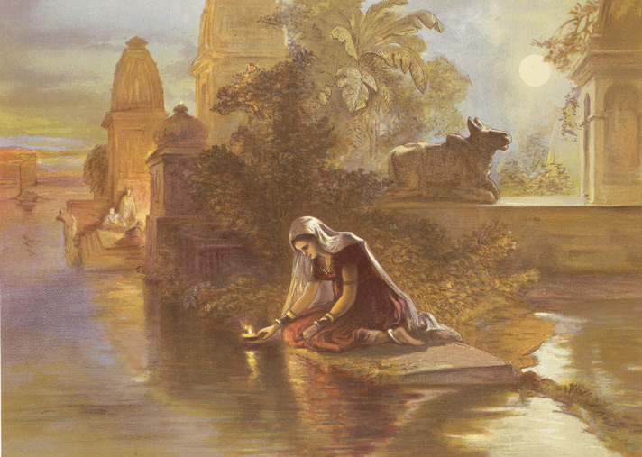
Chromolithograph,
"Indian woman floating lamps on the Ganges," by William Simpson,
1867.
The Ganges is a sacred river to Hindus along every fragment of
its length. All along its course, Hindus bathe in its waters, paying
homage to their ancestors and to their gods by cupping the water in their
hands, lifting it and letting it fall back into the river; they offer flowers
and rose petals and float shallow clay dishes filled with oil and lit with
wicks (diyas). On the journey back home from the Ganges, they carry small
quantities of river water with them for use in rituals (Ganga jal, literally
water of the Ganges).
The Ganges is the embodiment of all sacred waters in Hindu
mythology. Local rivers are said to be like the
Ganges, and are sometimes called the local Ganges (Ganga). The Kaveri river of Karnataka and Tamil
Nadu in Southern India is called the Ganges of the South;
the Godavari, is the Ganges that was led by the
sage Gautama to flow through Central India.
The Ganges is invoked whenever water is used in Hindu ritual, and is
therefore present in all sacred waters. In spite of this, nothing is more
stirring for a Hindu than a dip in the actual river, which is thought to remit
sins, especially at one of the famous tirthas such
as Gangotri, Haridwar, Prayag, or Varanasi. The
symbolic and religious importance of the Ganges is one of the few things that
Hindu India, even its skeptics, are agreed upon. Jawaharlal Nehru, a
religious iconoclast himself, asked for a handful of his ashes to be thrown
into the Ganges. "The Ganga," he wrote in his will, "is the
river of India, beloved of her people, round which are intertwined her racial
memories, her hopes and fears, her songs of triumph, her victories and her
defeats. She has been a symbol of India's age-long culture and civilization,
ever-changing, ever-flowing, and yet ever the same Ganga.
Avatarana or Descent of the Ganges
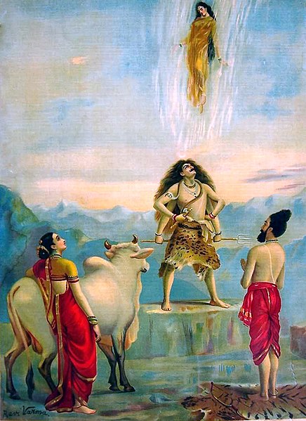
In late May or early June every year, Hindus celebrate the avatarana or
descent of the Ganges from heaven to earth. The day of the
celebration, Ganga Dashahara, the dashami (tenth
day) of the waxing moon of the Hindu
calendar month Jyestha, brings throngs of
bathers to the banks of the river.A soak in the Ganges on this day is said to
rid the bather of ten sins (dasha = Sanskrit "ten"; hara = to
destroy) or alternatively, ten lifetimes of sins. Those who cannot journey
to the river, however, can achieve the same results by bathing in any nearby
body of water, which, for the true believer, in the Hindu tradition, takes on
all the attributes of the Ganges.
The avatarana is an old theme in Hinduism with
a number of different versions of the story.In the Vedic version, Indra,
the Lord of Svarga(Heaven) slays
the celestial serpent, Vritra,
releasing the celestial liquid, the soma, or the
nectar of the gods which then plunges to the earth and waters it with
sustenance.
In the Vaishnava version
of the myth, Indra has been replaced by his former helper Vishnu. The
heavenly waters are now a river called Vishnupadi (padi:
Skt. "from the foot of").As he completes his celebrated three
strides—of earth, sky, and heaven—Vishnu as Vamana stubs his toe on the vault of
heaven, punches open a hole, and releases the Vishnupadi, which
until now had been circling around the cosmic egg within. Flowing out of
the vault, she plummets down to Indra's heaven, where she is received by Dhruva, the
once steadfast worshipper of Vishnu, now fixed in the sky as the polestar. Next,
she streams across the sky forming the Milky Way and
arrives on the moon. She then flows down earthwards to Brahma's realm,
a divine lotus atop Mount
Meru, whose petals form the earthly continents. There, the divine
waters break up, with one stream, the Alaknanda, flowing down one petal into
Bharatvarsha (India) as the Ganges.
It is Shiva, however, among the major deities of the Hindu pantheon, who
appears in the most widely known version of the avatarana story. Told
and retold in the Ramayana, the Mahabharata and
several Puranas, the story begins with a sage, Kapila, whose intense meditation has been
disturbed by the sixty thousand sons of King Sagara.
Livid at being disturbed, Kapila sears them with his angry gaze, reduces them
to ashes, and dispatches them to the netherworld. Only the waters of the
Ganges, then in heaven, can bring the dead sons their salvation. A descendant
of these sons, King Bhagiratha, anxious to
restore his ancestors, undertakes rigorous penance and is eventually granted
the prize of Ganga's descent from heaven. However, since her turbulent force
would also shatter the earth, Bhagiratha persuades Shiva in his abode on Mount
Kailash to receive Ganga in the coils of his tangled hair and
break her fall. Ganga descends, is tamed in Shiva's locks, and arrives in the
Himalayas. She is then led by the waiting Bhagiratha down into the plains at
Haridwar, across the plains first to the confluence with the Yamuna at
Prayag and then to Varanasi, and eventually to Ganga
Sagar, where she meets the ocean, sinks to the netherworld, and saves
the sons of Sagara.In honour of Bhagirath's pivotal role in the avatarana,
the source stream of the Ganges in the Himalayas is named Bhagirathi,
(Sanskrit, "of Bhagiratha").
Redemption
of the Dead

Preparations
for cremations on the banks of the Ganges in Varanasi, 1903.
The dead are being bathed, wrapped in cloth and covered with wood. The
photograph has caption, "Who dies in the waters of the Ganges obtains
heaven."
Since Ganga had descended from heaven to earth, she is also the
vehicle of ascent, from earth to heaven. As the Triloka-patha-gamini,
(Skt. triloka= "three worlds", patha =
"road", gamini = "one who travels") of the
Hindu tradition, she flows in heaven, earth, and
the netherworld, and,
consequently, is a "tirtha," or crossing point of all beings, the
living as well as the dead. It is for this reason that the story of
the avatarana is told at Shraddha ceremonies
for the deceased in Hinduism, and Ganges water is used in Vedic rituals after death.Among
all hymns devoted to the Ganges, there are none more popular than the ones
expressing the worshipers wish to breathe his last surrounded by her
waters.The Gangashtakam expresses this longing fervently:
O Mother! ... Necklace adorning the worlds!
Banner rising to heaven!
I ask that I may leave of this body on your banks,
Drinking your water, rolling in your waves,
Remembering your name, bestowing my gaze upon you.
Banner rising to heaven!
I ask that I may leave of this body on your banks,
Drinking your water, rolling in your waves,
Remembering your name, bestowing my gaze upon you.
No place along her banks is more longed for at the moment of
death by Hindus than Varanasi, the Great Cremation Ground, or Mahashmshana Those who are lucky
enough to die in Varanasi, are cremated on the banks of the Ganges, and are
granted instant salvation.If the death has occurred elsewhere, salvation can be
achieved by immersing the ashes in the Ganges. If the ashes have been
immersed in another body of water, a relative can still gain salvation for the
deceased by journeying to the Ganges, if possible during the lunar
"fortnight of the ancestors" in the Hindu calendar month of Ashwin (September or October), and
performing the Shraddha rites.
Hindus also perform pinda pradana, a rite for the dead,
in which balls of rice and sesame seed are offered to the Ganges while the
names of the deceased relatives are recited. Every sesame seed in every
ball thus offered, according to one story, assures a thousand years of heavenly
salvation for the each relative.Indeed, the Ganges is so important in the
rituals after death that the Mahabharata, in one of its
popular ślokas, says, "If only (one) bone of a (deceased)
person should touch the water of the Ganges, that person shall dwell honoured
in heaven. As if to illustrate this truism, the Kashi Khanda (Varanasi
Chapter) of the Skanda Purana recounts
the remarkable story of Vahika, a profligate and unrepentant sinner,
who is killed by a tiger in the forest. His soul arrives before Yama, the
Lord of Death, to be judged for the hereafter. Having no compensating virtue,
Vahika's soul is at once dispatched to hell. While
this is happening, his body on earth, however, is being picked at by vultures,
one of whom flies away with a foot bone. Another bird comes after the vulture,
and in fighting him off, the vulture accidentally drops the bone into the
Ganges below. Blessed by this happenstance, Vahika, on his way to hell, is
rescued by a celestial chariot which takes him instead to heaven.
The
Purifying Ganges

Devotees
taking holy bath during festival of Ganga Dashara at Har-ki-Pauri, Haridwar
Hindus consider the waters of the Ganges to be both pure and
purifying Nothing reclaims order from disorder more than the waters of the
Ganges. Moving water, as in a river, is considered purifying in Hindu
culture because it is thought to both absorb impurities and take them away.The
swiftly moving Ganges, especially in its upper reaches, where a bather has to
grasp an anchored chain in order to not be carried away, is considered
especially purifying. What the Ganges removes, however, is not necessarily
physical dirt, but symbolic dirt; it wipes away the sins of the bather, not
just of the present, but of a lifetime.
A popular paean to the Ganges is the Ganga Lahiri composed
by a seventeenth century poet Jagannatha who, legend has it, was turned out of
his Hindu Brahmin caste for carrying on an affair with a
Muslim woman. Having attempted futilely to be rehabilitated within the Hindu
fold, the poet finally appeals to Ganga, the hope of the hopeless, and the
comforter of last resort. Along with his beloved, Jagannatha sits at the top of
the flight of steps leading to the water at the famous Panchganga Ghat in
Varanasi. As he recites each verse of the poem, the water of the Ganges rises
up one step, until in the end it envelops the lovers and carry them
away. "I come to you as a child to his mother," begins the Ganga
Lahiri.
I come as an orphan to you, moist with love.
I come without refuge to you, giver of sacred rest.
I come a fallen man to you, uplifter of all.
I come undone by disease to you, the perfect physician.
I come, my heart dry with thirst, to you, ocean of sweet wine.
Do with me whatever you will.
I come without refuge to you, giver of sacred rest.
I come a fallen man to you, uplifter of all.
I come undone by disease to you, the perfect physician.
I come, my heart dry with thirst, to you, ocean of sweet wine.
Do with me whatever you will.
Consort,
Shakti, and Mother
Ganga is a consort to all three major male deities of Hinduism. As Brahma's
partner she always travels with him in the form of water in his kamandalu (water-pot). She is
also Vishnu's
consort. Not only does she emanate from his foot as Vishnupadi in
the avatarana story, but is also, with Sarasvati and Lakshmi, one of
his co-wives.In one popular story, envious of being outdone by each other, the
co-wives begin to quarrel. While Lakshmi attempts to mediate the quarrel, Ganga
and Sarasvati, heap misfortune on each other. They curse each other to become
rivers, and to carry within them, by washing, the sins of their human
worshippers. Soon their husband, Vishnu, arrives and decides to calm the
situation by separating the goddesses. He orders Sarasvati to become the wife
of Brahma, Ganga to become the wife of Shiva, and Lakshmi, as the blameless
conciliator, to remain as his own wife. Ganga and Sarasvati, however, are so
distraught at this dispensation, and wail so loudly, that Vishnu is forced to
take back his words. Consequently, in their lives as rivers they are still
thought to be with him.
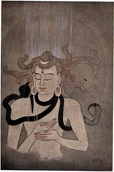
Shiva, as Gangadhara,
bearing the Descent of the Ganges, as the
goddess Parvati, the sage Bhagiratha, and the bull Nandi look
on (circa 1740).
It is Shiva's relationship with Ganga, that is the best-known in Ganges
mythology. Her descent, the avatarana is not a one time event,
but a continuously occurring one in which she is forever falling from heaven
into his locks and being forever tamed. Shiva, is depicted in Hindu iconography
as Gangadhara, the "Bearer of the Ganga," with Ganga,
shown as spout of water, rising from his hair.[71] The
Shiva-Ganga relationship is both perpetual and intimate. Shiva is
sometimes called Uma-Ganga-Patiswara ("Husband and Lord
of Uma (Parvati) and Ganga"), and Ganga often arouses the jealousy of
Shiva's better-known consort Parvati.
Ganga is the shakti or the moving, restless,
rolling energy in the form of which the otherwise recluse and unapproachable
Shiva appears on earth. As water, this moving energy can be felt, tasted, and
absorbed. The war-god Skanda addresses
the sage Agastya in the Kashi Khand of
the Skanda Purana in
these words:
One should not be amazed ... that this Ganges is really Power,
for is she not the Supreme Shakti of the Eternal Shiva, taken in the form of
water?
This Ganges, filled with the sweet wine of compassion, was sent out for the salvation of the world by Shiva, the Lord of the Lords.
Good people should not think this Triple-Pathed River to be like the thousand other earthly rivers, filled with water.
This Ganges, filled with the sweet wine of compassion, was sent out for the salvation of the world by Shiva, the Lord of the Lords.
Good people should not think this Triple-Pathed River to be like the thousand other earthly rivers, filled with water.
The Ganges is also the mother, the Ganga Mata (mata="mother")
of Hindu worship and culture, accepting all and forgiving all. Unlike
other goddesses, she has no destructive or fearsome aspect, destructive though
she might be as a river in nature. She is also a mother to other
gods. She accepts Shiva's incandescent seed from the fire-god Agni, which
is too hot for this world, and cools it in her waters. This union produces
Skanda, or Kartikeya, the god of war.In the Mahabharata, she is
the wife of Shantanu, and the mother of heroic
warrior-patriarch, Bhishma. When Bhishma is
mortally wounded in battle, Ganga comes out of the water in human form and
weeps uncontrollably over his body.
The Ganges is the distilled lifeblood of the Hindu tradition, of
its divinities, holy books, and enlightenment. As such, her worship does
not require the usual rites of invocation (avahana) at the beginning and
dismissal (visarjana) at the end, required in the worship of other gods.
Her divinity is immediate and everlasting.
Ganges in
classical Indian iconography
|


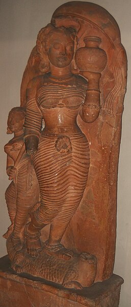

Early in ancient Indian culture, the river Ganges was associated
with fecundity, its redeeming waters and its rich silt providing sustenance to
all who lived along its banks. A counterpoise to the dazzling heat of the
Indian summer, the Ganges came to be imbued with magical qualities and to be
revered in anthropomorphic form. By the 5th century CE, an elaborate
mythology surrounded the Ganges, now a goddess in her own right, and a symbol
for all rivers of India. Hindu temples all over India had statues and
reliefs of the goddess carved at their entrances, symbolically washing the sins
of arriving worshippers and guarding the gods within. As protector of
the sanctum sanctorum, the goddess soon came to
depicted with several characteristic accessories: the makara (a
crocodile-like undersea monster, often shown with an elephant-like trunk),
the kumbha (an overfull vase), various
overhead parasol-like coverings, and a gradually increasing retinue of humans.
Central to the goddess's visual identification is the makara,
which is also her vahana, or mount. An
ancient symbol in India, it pre-dates all appearances of the goddess Ganga in
art. The makara has a dual symbolism. On the one hand, it
represents the life-affirming waters and plants of its environment; on the
other, it represents fear, both fear of the unknown it elicits by lurking in
those waters and real fear it instils by appearing in sight. The earliest
extant unambiguous pairing of the makara with Ganga is
at Udayagiri Caves in
Central India (circa 400 CE). Here, in Cave V, flanking the main figure of Vishnu shown in his boar
incarnation, two river goddesses, Ganga and Yamuna appear
atop their respective mounts, makara and kurma (a
turtle or tortoise).
The makara is often accompanied by a gana,
a small boy or child, near its mouth, as, for example, shown in the Gupta
period relief from Besnagar, Central India,
in the left-most frame above. The gana represents both
posterity and development (udbhava). The pairing of the fearsome,
life-destroying makara with the youthful, life-affirming gana speaks
to two aspects of the Ganges herself. Although she has provided sustenance to
millions, she has also brought hardship, injury, and death by causing major
floods along her banks. The goddess Ganga is also accompanied by a dwarf
attendant, who carries a cosmetic bag, and on whom she sometimes leans, as if
for support. (See, for example, frames 1, 2, and 4 above.)
The purna kumbha or full pot of water is the
second most discernible element of the Ganga iconography. Appearing first
also in the relief in Udayagiri Caves (5th century), it gradually appeared more
frequently as the theme of the goddess matured. By the seventh century it
had become an established feature, as seen, for example, the Dashavatara temple, Deogarh, Uttar Pradesh (seventh century),
the Trimurti temple, Badoli, Chittorgarh, Rajasthan, and at the Lakshmaneshwar
temple, Kharod, Bilaspur,
Chhattisgarh, (ninth or tenth century), and seen very clearly
in frame 3 above and less clearly in the remaining frames. Worshipped even
today, the full pot is emblematic of the formless Brahman, as well
as of woman, of the womb, and of birth. Furthermore, the river goddesses
Ganga and Saraswati were both born from Brahma's pot, containing the celestial
waters.
In her earliest depictions at temple entrances, the goddess
Ganga appeared standing beneath the overhanging branch of a tree, as seen as
well in the Udayagiri caves. However, soon the tree cover had evolved into
a chatra or parasol held by an
attendant, for example, in the seventh-century Dasavatara temple at Deogarh. (The
parasol can be clearly seen in frame 3 above; its stem can be seen in frame 4,
but the rest has broken off.) The cover undergoes another transformation in the
temple at Kharod, Bilaspur (ninth or tenth century), where the parasol is
lotus-shaped, and yet another at the Trimurti temple at Badoli where the
parasol has been replaced entirely by a lotus.
As the iconography evolved, sculptors in the central India
especially were producing animated scenes of the goddess, replete with an
entourage and suggestive of a queen en route to a river to bathe. A relief
similar to the depiction in frame 4 above, is described in Pal 1997,
p. 43 as follows:
A typical relief of about the ninth century that once stood at
the entrance of a temple, the river goddess Ganga is shown as a voluptuously
endowed lady with a retinue. Following the iconographic prescription, she
stands gracefully on her composite makara mount and holds a
water pot. The dwarf attendant carries her cosmetic bag, and a ... female holds
the stem of a giant lotus leaf that serves as her mistress's parasol. The
fourth figure is a male guardian. Often in such reliefs the makara's
tail is extended with great flourish into a scrolling design symbolizing both
vegetation and water.
Kumbh Mela

A
procession of Akharasmarching over a makeshift bridge over
the Ganges River. Kumbh Mela at Allahabad, 2001.
Main
article: Kumbh Mela
Kumbh Mela is a mass Hindu pilgrimage in
which Hindus gather at the Ganges River. The normal Kumbh Mela is
celebrated every 3 years, the Ardh (half) Kumbh is celebrated
every six years at Haridwar and Prayag, the Purna (complete)
Kumbh takes place every twelve years at four places (Prayag (Allahabad), Haridwar, Ujjain,
and Nashik).
The Maha (great) Kumbh Mela which comes after 12 'Purna Kumbh
Melas', or 144 years, is held at Prayag (Allahabad).
The major event of the festival is ritual bathing at the banks of the river.
Other activities include religious discussions, devotional singing, mass
feeding of holy men and women and the poor, and religious assemblies where
doctrines are debated and standardized. Kumbh Mela is the most sacred of all
the pilgrimages. Thousands of holy men and women attend, and the
auspiciousness of the festival is in part attributable to this. The sadhus are
seen clad in saffron sheets with ashes and powder dabbed on their skin per the
requirements of ancient traditions. Some, called naga sanyasis,
may not wear any clothes.
Irrigation
The Ganges and its all tributaries, especially the Yamuna, have
been used for irrigation since ancient times. Dams and canals were common
in gangetic plain by fourth century BCE. The Ganges-Brahmaputra-Meghna basin
has a huge hydroelectric potential, on the order of
200,000 to 250,000 megawatts, nearly half of which could be easily harnessed.
As of 1999, India tapped about 12% of the hydroelectric potential of the Ganges
and just 1% of the vast potential of the Brahmaputra.
Canals

Megasthenes, a Greek ethnographer who visited India
during third century BCE when Mauryans ruled India described the existence of
canals in the gangetic plain. Kautilya (also known as Chanakya), an advisor to Chandragupta Maurya, the founder of Maurya Empire, included the destruction of
dams and levees as a strategy during war. Firuz Shah Tughlaq had
many canals built, the longest of which, 240 km (150 mi), was built
in 1356 on the Yamuna River. Now known as the Western Yamuna Canal, it has
fallen into disrepair and been restored several times. The Mughal
emperor Shah Jahan built an irrigation canal on the Yamuna
River in the early 17th century. It fell into disuse until 1830, when it was
reopened as the Eastern Yamuna Canal, under British control. The reopened canal
became a model for the Upper Ganges Canal and all following canal projects.

The Ganges
Canal highlighted in red stretching between its headworks off the Ganges River
in Hardwar and
its confluences with the Jumna
River in Etawah and with the
Ganges in Cawnpore (now Kanpur).
The first British canal in India—with no Indian antecedents—was
the Ganges Canal built between 1842 and
1854. Contemplated first by Col. John Russell Colvin in 1836, it did not at
first elicit much enthusiasm from its eventual architect Sir Proby Thomas Cautley,
who balked at idea of cutting a canal through extensive low-lying land in order
to reach the drier upland destination. However, after the Agra famine of 1837–38, during which the East India Company's administration spent Rs. 2,300,000
on famine relief, the idea of a canal became more attractive to the Company's
budget-conscious Court of Directors. In 1839, the Governor General of India, Lord Auckland, with
the Court's assent, granted funds to Cautley for a full survey of the swath of
land that underlay and fringed the projected course of the canal. The Court of
Directors, moreover, considerably enlarged the scope of the projected canal,
which, in consequence of the severity and geographical extent of the famine,
they now deemed to be the entire Doab region.
The enthusiasm, however, proved to be short lived. Auckland's
successor as Governor General, Lord Ellenborough,
appeared less receptive to large-scale public works, and for the duration of
his tenure, withheld major funds for the project. Only in 1844, when a new
Governor-General, Lord Hardinge, was
appointed, did official enthusiasm and funds return to the Ganges canal
project. Although the intervening impasse had seemingly affected Cautley's
health and required him to return to Britain in 1845 for recuperation, his
European sojourn gave him an opportunity to study contemporary hydraulic works
in the United Kingdom and Italy. By the time of his return to India even more
supportive men were at the helm, both in the North-Western Provinces, with James Thomason as
Lt. Governor, and in British
India with Lord Dalhousie as
Governor-General. Canal construction, under Cautley's supervision, now went
into full swing. A 560 km (350 mi) long canal, with another
480 km (300 mi) of branch lines, eventually stretched between the
headworks in Hardwar, splitting into two branches below Aligarh, and its
two confluences with the Yamuna (Jumna in map) mainstem in Etawah and the Ganges in Kanpur (Cawnpore
in map). The Ganges Canal, which required a total capital outlay of £2.15
million, was officially opened in 1854 by Lord Dalhousie. According to
historian Ian Stone:
It was the largest canal ever attempted in the world, five times
greater in its length than all the main irrigation lines of Lombardy and
Egypt put together, and longer by a third than even the largest USA navigation
canal, the Pennsylvania Canal.
Dams and
barrages
A major barrage at Farakka was opened on 21 April
1975, It is located close to the point where the main flow of the river
enters Bangladesh, and the tributary Hooghly (also known as Bhagirathi)
continues in West Bengal past Kolkata. This barrage, which feeds the Hooghly
branch of the river by a 42 km (26 mi) long feeder canal, and its
water flow management has been a long-lingering source of dispute with
Bangladesh. Indo-Bangladesh Ganges Water
Treaty signed in December 1996 addressed some of the water
sharing issues between India and Bangladesh.
Tehri Dam was constructed on Bhagirathi River,
tributary of the Ganges. It is located 1.5 km downstream of Ganesh Prayag,
the place where Bhilangana meets Bhagirathi. Bhagirathi is called Ganges after
Devprayag. Construction of the dam in an earthquake prone area was
controversial.
Bansagar Dam was built on the Son River, a
tributary of the Ganges for both irrigation and hydroelectric power
generation.
Economy

A girl
selling plastic containers for carrying Ganges water, Haridwar.
The Ganges
Basin with its fertile soil is instrumental to the agricultural
economies of India and Bangladesh. The Ganges and its tributaries provide a
perennial source of irrigation to a large area. Chief crops cultivated in the
area include rice, sugarcane, lentils, oil seeds,
potatoes, and wheat. Along the banks of the river, the presence of swamps and
lakes provide a rich growing area for crops such as legumes, chillies, mustard,
sesame, sugarcane, and jute. There are also many fishing opportunities along
the river, though it remains highly polluted. Also the major industrial towns
of Unnao, Kanpur,
situated on the banks of the river with the predominance of tanning industries
add to the pollution.
Tourism
Tourism is another related activity. Three towns holy to Hinduism—Haridwar, Prayag (Allahabad), and Varanasi—attract
thousands of pilgrims to its waters to take a dip in the Ganges, which is
believed to cleanse oneself of sins and help attain salvation. The rapids of
the Ganges also are popular for river
rafting, attracting adventure seekers in the summer months. Also,
several cities such as Kanpur, Kolkata and Patna have developed riverfront
walkways along the banks to attract tourists.
Ecology and environment

Ganges
from Space
Human development, mostly agriculture, has replaced nearly all
of the original natural vegetation of the Ganges basin. More than 95% of the
upper Gangetic Plain has been degraded or converted to agriculture or urban
areas. Only one large block of relatively intact habitat remains, running along
the Himalayan foothills and including Rajaji National Park, Jim Corbett National Park,
and Dudhwa National Park.
As recently as the 16th and 17th centuries the upper Gangetic Plain harboured
impressive populations of wild Asian
elephants (Elephas maximus), Bengal
tigers (Panthera t. tigris), Indian
rhinoceros (Rhinoceros unicornis), gaurs (Bos
gaurus), barasinghas (Rucervus
duvaucelii), sloth bears(Melursus ursinus) and Indian
lions (Panthera leo persica).] In
the 21st century there are few large wild animals, mostly deer, wild
boars, wildcats, and small numbers of Indian
wolves, golden
jackals, and red and Bengal
foxes. Bengal tigers survive only in the Sundarbans area
of the Ganges Delta. The Sundarbands freshwater swamp ecoregion, however, is
nearly extinct. Threatened mammals in the upper Gangetic Plain
include the tiger, elephant, sloth bear, and four-horned antelope (Tetracerus quadricornis).

Lesser
florican (Sypheotides indicus)
Many types of birds are found throughout the basin, such
as myna, Psittacula parakeets, crows, kites, partridges,
and fowls. Ducks and snipesmigrate
across the Himalayas during the winter, attracted in large numbers to wetland
areas. There are no endemic birds
in the upper Gangetic Plain. The great Indian bustard (Ardeotis nigriceps)
and lesser florican (Sypheotides indicus)
are considered globally threatened.
The natural forest of the upper Gangetic Plain has been so
thoroughly eliminated it is difficult to assign a natural vegetation type with
certainty. There are a few small patches of forest left, and they suggest that
much of the upper plains may have supported a tropical
moist deciduous forest with sal (Shorea robusta) as a climax
species.
A similar situation is found in the lower Gangetic Plain, which
includes the lower Brahmaputra River. The lower plains contain more open
forests, which tend to be dominated by Bombax ceiba in association
with Albizzia
procera, Duabanga grandiflora,
and Sterculia
vilosa. There are early seral forest
communities that would eventually become dominated by the climax species sal (Shorea
robusta), if forest succession was allowed to proceed. In most places
forests fail to reach climax conditions due to human causes. The forests
of the lower Gangetic Plain, despite thousands of years of human settlement,
remained largely intact until the early 20th century. Today only about 3% of
the ecoregion is under natural forest and only one large block, south of
Varanasi, remains. There are over forty protected areas in the ecoregion, but
over half of these are less than 100 square kilometres (39 sq mi). The
fauna of the lower Gangetic Plain is similar to the upper plains, with the
addition of a number of other species such as the smooth-coated otter (Lutrogale perspicillata)
and the large Indian civet (Viverra zibetha).
Fish

The catla (Catla
catla) is one of the Indian carp species that support major fisheries in
the Ganges
It has been estimated that about 350 fish species live in the
entire Ganges drainage, including several endemics.] In
a major 2007–2009 study of fish in the Ganges basin (including the river itself
and its tributaries, but excluding the Brahmaputra and Meghna basins), a total
of 143 fish species were recorded, including 10 non-native introduced species. The most diverse orders
are Cypriniformes (barbs
and allies), Siluriformes (catfish)
and Perciformes (perciform fish), each
comprising about 50%, 23% and 14% of the total fish species in the drainage.
There are distinct differences between the different sections of
the river basin, but Cyprinidae is the
most diverse throughout. In the upper section (roughly equalling the basin
parts in Uttarakhand) more than 50 species have been recorded and Cyprinidae
alone accounts for almost 80% those, followed by Balitoridae (about 15.6%) and Sisoridae (about 12.2%).Sections of the
Ganges basin at altitudes above 2,400–3,000 m (7,900–9,800 ft) above
sea level are generally without fish. Typical genera approaching this altitude
are Schizothorax, Tor, Barilius, Nemacheilus and Glyptothorax. About 100 species have been
recorded from the middle section of the basin (roughly equalling the sections
in Uttar Pradesh and parts of Bihar) and more than 55% of these are in family
Cyprinidae, followed by Schilbeidae (about
10.6%) and Clupeidae (about
8.6%). The lower section (roughly equalling the basin in parts of Bihar
and West Bengal) includes major floodplains and is home to almost 100 species.
About 46% of these are in the family Cyprinidae, followed by Schilbeidae (about
11.4%) and Bagridae (about 9%).
The Ganges basin supports major fisheries, but these have
declined in recent decades. In the Allahabad region
in the middle section of the basin, catches of carp fell from 424.91 metric
tons in 1961–1968 to 38.58 metric tons in 2001–2006, and catches of catfish
fell from 201.35 metric tons in 1961–1968 to 40.56 metric tons in
2001–2006. In the Patnaregion in the lower
section of the basin, catches of carp fell from 383.2 metric tons to 118, and
catfish from 373.8 metric tons to 194.48. Some of the fish commonly caught
in fisheries include catla (Catla catla), golden
mahseer (Tor putitora), tor
mahseer (Tor tor), rohu (Labeo
rohita), walking catfish (Clarias batrachus), pangas catfish (Pangasius pangasius), goonch catfish (Bagarius), snakeheads (Channa), bronze featherback (Notopterus notopterus)
and milkfish (Chanos chanos).
The Ganges basin is home to about 30 fish species that are
listed as threatened with the primary issues being overfishing (sometimes
illegal), pollution, water abstraction, siltationand invasive
species. Among the threatened species is the critically endangered Ganges
shark (Glyphis gangeticus). Several fish species migrate between
different sections of the river, but these movements may be prevented by the
building of dams.
Crocodilians
and turtles

The
threatened gharial (Gavialis gangeticus) is a large fish-eating crocodilian that
is harmless to humans[112]
The main sections of the Ganges River are home to the gharial (Gavialis
gangeticus) and mugger
crocodile (Crocodylus palustris), and the delta is
home to the saltwater crocodile (C. porosus). Among
the numerous aquatic and semi-aquatic turtles in the Ganges basin are the northern river terrapin (Batagur baska; only
in the lowermost section of the basin), three-striped roofed turtle (B.
dhongoka), red-crowned roofed turtle (B.
kachuga), black
pond turtle (Geoclemys hamiltonii), Brahminy river turtle (Hardella
thurjii), Indian black turtle (Melanochelys trijuga), Indian eyed turtle (Morenia petersi), brown roofed turtle (Pangshura smithii), Indian roofed turtle (Pangshura tecta), Indian tent turtle(Pangshura tentoria), Indian flapshell turtle (Lissemys punctata), Indian narrow-headed softshell
turtle (Chitra indica), Indian softshell turtle(Nilssonia gangetica), Indian peacock softshell turtle (N.
hurum) and Cantor's giant softshell turtle (Pelochelys
cantorii; only in the lowermost section of Ganges basin). Most of
these are seriously threatened.
Ganges
river dolphin

The
Gangetic dolphin in a sketch by Whymper and P. Smit, 1894.
The river's most famed fauna is the freshwater dolphin Platanista
gangetica gangetica, the Ganges river dolphin, recently declared India's national aquatic animal.[
This dolphin used to exist in large schools near to urban
centres in both the Ganges and Brahmaputra rivers, but is now seriously
threatened by pollution and dam construction. Their numbers have now dwindled
to a quarter of their numbers of fifteen years before, and they have become
extinct in the Ganges' main tributaries. A recent survey by the World Wildlife Fund found only 3,000 left in
the water catchment of both river systems.[
The Ganges river dolphin is one of only five true freshwater dolphins in the world. The other
four are the baiji (Lipotes vexillifer) of
the Yangtze River in China, now likely
extinct; the Indus river dolphin of the Indus River in
Pakistan; the Amazon river dolphin of the Amazon River in
South America; and the Araguaian river
dolphin (not considered a separate species until 2014) of
the Araguaia–Tocantins basin in Brazil. There are
several marine dolphins whose ranges include some freshwater habitats, but
these five are the only dolphins who live only in freshwater rivers and lakes.
Effects of
climate change
The Tibetan
Plateau contains the world's third-largest store of ice. Qin Dahe,
the former head of the China Meteorological Administration, said that the
recent fast pace of melting and warmer temperatures will be good for
agriculture and tourism in the short term; but issued a strong warning:
Temperatures are rising four times faster than elsewhere in
China, and the Tibetan glaciers are retreating at a higher speed than in any
other part of the world.... In the short term, this will cause lakes to expand
and bring floods and mudflows... In the long run, the glaciers are vital
lifelines for Asian rivers, including the Indus and the Ganges. Once they
vanish, water supplies in those regions will be in peril.
In 2007, the Intergovernmental Panel on
Climate Change (IPCC), in its Fourth Report, stated that the Himalayan
glaciers which feed the river, were at risk of melting by 2035. The IPCC has
now withdrawn that prediction, as the original source admitted that it was
speculative and the cited source was not a peer reviewed finding. In its
statement, the IPCC stands by its general findings relating to the Himalayan
glaciers being at risk from global warming (with consequent risks to water flow
into the Gangetic basin).
Pollution and environmental
concerns
Pollution of the Ganges

People
bathing and washing clothes in the Ganges in Varanasi.
The Ganges suffers from extreme pollution levels, caused by the
400 million people who live close to the river. Sewage from many cities
along the river's course, industrial waste and religious offerings wrapped in
non-degradable plastics add large amounts of pollutants to the river as it
flows through densely populated areas. The problem is exacerbated by the
fact that many poorer people rely on the river on a daily basis for bathing,
washing, and cooking. The World
Bank estimates that the health costs of water pollution in India equal
three percent of India's GDP. It has also been suggested that eighty
percent of all illnesses in India and one-third of deaths can be attributed to
water-borne diseases.
Varanasi, a city of one million people that many
pilgrims visit to take a "holy dip" in the Ganges, releases around
200 million litres of untreated human sewage into the river each day, leading
to large concentrations of faecal coliform bacteria. According
to official standards, water safe for bathing should not contain more than 500
faecal coliforms per 100ml, yet upstream of Varanasi's
ghats the river water already contains 120 times as much, 60,000
faecal coliform bacteria per 100 ml.
After the cremation of
the deceased at Varanasi's ghats the bones and ashes are thrown into the
Ganges. However, in the past thousands of uncremated bodies were thrown into
the Ganges during cholera epidemics, spreading the disease. Even
today, holy men, pregnant women, people with leprosy/chicken
pox, people who had been bitten by snakes, people who had committed
suicide, the poor, and children under 5 are not cremated at the ghats but are
floated free to decompose in the waters. In addition, those who cannot afford
the large amount of wood needed to incinerate the entire body, leave behind a
lot of half burned body parts.
After passing through Varanasi, and receiving 32 streams of raw
sewage from the city, the concentration of fecal coliforms in the river's
waters rises from 60,000 to 1.5 million, with observed peak values of 100
million per 100 ml. Drinking and bathing in its waters therefore carries a high
risk of infection.
Between 1985 and 2000, Rs. 10 billion,
around US$226 million, or less than 4 cents per person per year, were
spent on the Ganga
Action Plan, an environmental initiative that was "the largest
single attempt to clean up a polluted river anywhere in the
world." The Ganga Action Plan has been described variously as a
"failure", a "major failure".
According to one study,
The Ganga Action Plan, which was taken on priority and with much
enthusiasm, was delayed for two years. The expenditure was almost doubled. But
the result was not very appreciable. Much expenditure was done over the
political propaganda. The concerning governments and the related agencies were
not very prompt to make it a success. The public of the areas was not taken
into consideration. The releasing of urban and industrial wastes in the river
was not controlled fully. The flowing of dirty water through drains and sewers
were not adequately diverted. The continuing customs of burning dead bodies,
throwing carcasses, washing of dirty clothes by washermen, and immersion of
idols and cattle wallowing were not checked. Very little provision of public
latrines was made and the open defecation of lakhs of people continued along
the riverside. All these made the Action Plan a failure.
The failure of the Ganga Action Plan, has also been variously
attributed to "environmental planning without proper understanding of the
human–environment interactions,” Indian "traditions and
beliefs,"corruption and a lack of technical knowledge" and
"lack of support from religious authorities."
In December 2009 the World Bank agreed to loan India US$1
billion over the next five years to help save the river. According to 2010
Planning Commission estimates, an investment of almost Rs. 70 billion (Rs.
70 billion, approximately US$1.5 billion) is needed to clean up the river.
In November 2008, the Ganges, alone among India's rivers, was
declared a "National River", facilitating the formation of a National Ganga River Basin
Authority that would have greater powers to plan, implement and monitor
measures aimed at protecting the river.
In July 2014, the Government of India announced an integrated
Ganges-development project titled Namami Ganga and
allocated ₹2,037 crore for this purpose.
In March 2017 the High Court of Uttarakhand declared the Ganges
River a legal "person", in a move that according to one
newspaper, "could help in efforts to clean the pollution-choked
rivers." As of 6 April 2017, the ruling has been commented on in
Indian newspapers to be hard to enforce, that experts do not anticipate
immediate benefits, that the ruling is "hardly game changing," that
experts believe "any follow-up action is unlikely,"] and
that the "judgment is deficient to the extent it acted without hearing
others (in states outside Uttarakhand) who have stakes in the matter."
The incidence of water-borne and enteric diseases—such
as gastrointestinal disease, cholera, dysentery, hepatitis
A and typhoid—among
people who use the river's waters for bathing, washing dishes and brushing
teeth is high, at an estimated 66% per year.
Recent studies by Indian Council of Medical
Research (ICMR) say that the river is so full of killer pollutants
that those living along its banks in Uttar Pradesh, Bihar and Bengal are more
prone to cancer than anywhere else in the country. Conducted by the National Cancer
Registry Programme under the ICMR, the study throws up shocking findings
indicating that the river is thick with heavy metals and lethal chemicals that
cause cancer. According to Deputy Director General of NCRP A. Nandkumar, the
incidence of cancer was highest in the country in areas drained by the Ganges
and stated that the problem would be studied deeply and with the findings
presented in a report to the health ministry.
Water
shortages
Along with ever-increasing pollution, water shortages are getting
noticeably worse. Some sections of the river are already completely dry. Around
Varanasi, the river once had an average depth of 60 metres (200 ft), but
in some places, it is now only 10 metres (33 ft).
To cope with its chronic water shortages, India employs electric
groundwater pumps, diesel-powered tankers, and coal-fed power plants. If the
country increasingly relies on these energy-intensive short-term fixes, the
whole planet's climate will bear the consequences. India is under enormous
pressure to develop its economic potential while also protecting its
environment—something few, if any, countries have accomplished. What India does
with its water will be a test of whether that combination is possible.
Meghna River
The Meghna River (Bengali: মেঘনা নদী) is one of the most important rivers in Bangladesh, one of the three that forms the Ganges Delta, the largest delta on earth, which fans out to the Bay of
Bengal. A part of the Surma-Meghna
River System, Meghna is formed inside Bangladesh in Kishoreganj District above
the town of Bhairab Bazar by
the joining of the Surma and
the Kushiyara, both
of which originate in the hilly regions of eastern India as the Barak River. The Meghna meets its major tributary, the Padma, in Chandpur District. Other major tributaries of the Meghna
include the Dhaleshwari,
the Gumti, and
the Feni. The Meghna empties into the Bay of Bengal in Bhola District via four principal mouths,
named Tetulia (Ilsha),
Shahbazpur, Hatia, and Bamni.

Boat in Meghna River
The Meghna is the widest river among those that flow completely
inside the boundaries of Bangladesh. At a point near Bhola, Meghna is 12 km wide. In its lower
reaches this river's path is almost perfectly straight.
Course
The Meghna is formed inside Bangladesh by
the joining of the Surma and Kushiyara rivers originating from the
hilly regions of eastern India. Down
to Chandpur, Meghna is hydrographically referred to as
the Upper Meghna. After the Padma joins,
it is referred to as the Lower Meghna.
Near Muladhuli in Barisal district,
the Safipur
River is an offshoot of the Surma that creates one of the main
rivers in South Bengal. 1.5 km wide, this river is one of the widest in
the country as well.
At Chatalpar of Brahmanbaria District,
the river Titas emerges from Meghna and after circling two large bends by
a distance of about 150 mile, falls into the Meghna again near Nabinagar Upazila. The Titas forms as a single
stream but braids into two distinct streams which remain separate before
re-joining the Meghna.

A view of
the Meghna from a bridge
In Daudkandi, (Comilla District), the Meghna is joined by
the Gumti River,
which increases the Meghna's waterflow considerably. The pair of bridges over
the Meghna and Gumti are two of the country's largest bridges.
Meghna is again reinforced by the Dhaleshwari before Chandpur. Further
down, the Padma River- the largest distributary of the Ganges in
Bangladesh, along with the Jamuna River-
the largest distributary of the Brahmaputra, join with the Meghna in Chandpur
District, resulting in the Lower Meghna.
When the brown and hazy water of the Padma mix with the clear
water of the Upper Meghna, the two streams do not mix but flow in parallel down
to the sea - making half of the river clear and the other half brown. This
peculiarity of the river is always a great attraction for people.
After Chandpur, the
combined flow of the Padma, Jamuna and
Meghna moves down to the Bay of
Bengal in an almost straight line, braiding occasionally into a
number of riverines including the Pagli, Katalia, Dhonagoda, Matlab and
Udhamodi. All of these rivers rejoin the Meghna at different points downstream.
Near Bhola, just
before flowing into the Bay of Bengal, the river again divides into
two main streams in the Ganges delta and separates an island from both sides of
the mainland. The western stream is called Ilsha while the eastern one is
called Bamni.
Jamuna River
(Bangladesh)
The Jamuna River (Bengali: যমুনা Jomuna)
is one of the three main rivers of Bangladesh. It is
the main distributary channel
of the Brahmaputra River as
it flows from India to
Bangladesh. The Jamuna flows south and joins the Padma River (Pôdda),
near Goalundo Ghat, before meeting the Meghna River near
Chandpur. It then flows into the Bay of Bengal as
the Meghna River. It is the National river of
Bangladesh.
The Brahmaputra-Jamuna is a classic example of a braided river and
is highly susceptible to channel migration and avulsion.[1] It is characterised by a
network of interlacing channels with numerous sandbars enclosed
between them. The sandbars, known in Bengali as chars,
do not occupy a permanent position. The river deposits them in one year, very
often to be destroyed later, and redeposits them in the next rainy season. The
process of bank and deposit erosion together with redeposition has been going
on continuously,[2] making it difficult to
precisely demarcate the boundary between the district of Pabna on one side and
the districts of Mymensingh Tangail and Dhaka on the other. The breaking of a char or
the emergence of a new one is also a cause of much violence and litigation. The
confluence of the Jamuna River and Padma River is unusually unstable and has
been shown to have migrated southeast by over fourteen kilometres between 1972
and 2014.

Course
In Bangladesh, the Brahmaputra is joined by the Teesta River (or Tista), one
of its largest tributaries. The Teesta earlier ran due south from Jalpaiguri in three channels, namely,
the Karatoya to
the east, the Punarbhaba in
the west and the Atrai in the
centre. The three channels possibly gave the name to the river as Trisrota "possessed
of three streams" which has been shortened and corrupted to Teesta. Of
these three, the Punarbhaba joined the Mahananda. The Atrai passing through a vast
marshy area known as Chalan Beel joined
the Karatoya and the united stream joined the Padma (Ganges)
near Jafarganj. In the destructive floods of 1787, the Teesta river forsook its
old channel and rushing south-east it joined the Brahmaputra.
James Rennell made a survey between 1764
and 1777 and his maps are one of the earliest authentic maps of Bengal in
existence. In these maps Teesta is shown as flowing through North Bengal in
several branches — Punarbhaba, Atrai, Karatoya, etc. All these streams
combined lower down with the Mahananda, now the westernmost river in North
Bengal, and taking the name of Hoorsagar finally discharged into the
Ganges at Jafarganj, near modern Goalundo. The Hoorsagar river is still in
existence, being the combined outfall of the Baral, a spill channel of the Ganges, the
Atrai, the Jamuna or Jamuneswari (not the main Jamuna through which the
Brahmaputra now flows), and the Karatoya, but instead of falling into the
Ganges, it falls into the main Jamuna, a few miles above its
confluence with the Padma at Goalundo.
James
Rennell's 1776 map shows the Brahmaputra's main flow through Jamalpur and Mymensinghand a much narrower Jamuna or
Jamuneswari before an earthquake in 1762, and the Teesta R. flowing in 3 channels to the
Ganges before a flood in 1787.
Below the Teesta, the Brahmaputra splits into two distributary branches.
The western branch, which contains the majority of the river's flow, continues
due south as the Jamuna (Jomuna) to merge with the lower Ganges, called
the Padma River (Pôdda). The eastern branch,
formerly the larger but now much smaller, is called the lower or old
Brahmaputra (Bromhoputro). It curves southeast to join the Meghna River near Dhaka. The
Padma and Meghna converge near Chandpur and
flow out into the Bay of Bengal. This final part of the river is called Meghna.
In the past the course of the lower Brahmaputra was different
and passed through the Jamalpur and Mymensingh districts. In a major magnitude earthquake on April 2, 1762, the main channel of the
Brahmaputra at Bhahadurabad point was switched southwards and opened as Jamuna
due to the result of tectonic uplift of the Madhupur tract.
The Jamuna is a very wide river. During the rains it is about
5–8 miles (8.0–12.9 km) from bank to bank. Even during the dry season when
the waters subside, the breadth is hardly less than 2–3 miles
(3.2–4.8 km).
The Jamuna was a barrier in establishing a direct road link
between capital Dhaka and northern part of Bangladesh, better known as Rajshahi
Division, until 1996. This was mitigated by the completion of the Jamuna Multi-purpose Bridge. It is also a very
important waterway. It is navigable all year round by large
cargo and passenger steamers. Before the Partition of Bengal in
1947, passenger steamers used to ply up to Dibrugarh in the state of Assam in
the Indian Union. At present two steamer ferry services link
the district of Pabna with the districts of Mymensingh, Tangail and Dhaka.
The Bangladesh Railway maintains a ferry service
between Serajganj in Pabna and Jagannathganj in
Mymensingh. The other ferry service between Nagarbari in
Pabna and Aricha in Dhaka is run by the C & B Department.
Teesta River
The Teesta
River (or Tista River) is a 309 km (192 mi) long
river flowing through the Indian
states of West
Bengal and Sikkimthrough Bangladesh before emptying to the Bay of
Bengal. It carves out from the
verdant Himalayas & Singalila in temperate and tropical river Valleys
and forms the border between Sikkim and West
Bengal. It flows through the
cities of Rangpo, Jalpaiguri and Kalimpong and joins the Jamuna (Brahmaputra) in Bangladesh. It drains an area of 12,540 km2 (4,840 sq mi).
Course

Teesta and
Rangeet Confluence
The Teesta River originates from the Pahunri (or Teesta Kangse) glacier above
7,068 metres (23,189 ft), and flows southward through gorges and rapids in
the Sikkim Himalaya.
It is fed by rivulets arising
in the Thangu, Yumthang and Donkha mountain ranges. The river then flows past
the town of Rangpo where the Rangpo River joins, and where it forms
the border between Sikkim and West
Bengal up to Teesta Bazaar. Just before the Teesta Bridge,
where the roads from Kalimpong and Darjeeling join,
the river is met by its main tributary,
the Rangeet River.

Teesta
River Bridge Inscription
At this point, it changes course southwards flowing into West
Bengal. The river hits the plains at Sevoke, 22 kilometres (14 mi) northeast
of Siliguri, where it is spanned by the Coronation
Bridge linking the northeast states to the rest of India. The
river then goes merging up with the Brahmaputra
River after it bifurcates the city of Jalpaiguri and flows just
touching Cooch Behar district at Mekhliganj and moves to Fulchori in Bangladesh.
Geography

River
rafting on Teesta
Through its course, the Teesta river has carved out ravines and gorges in
Sikkim meandering through the hills with the hill
station of Kalimpong lying just off the river. Variegated vegetation
can be seen along this route. At lower elevations, tropicaldeciduous trees
and shrubs cover the surrounding hills; alpine
vegetation is seen at the upper altitudes. The river is flanked by
white sand which is used by the construction industry in the region. Large
boulders in and around the waters make it ideal for rafting enthusiasts.
Between Rangpo town and the railway bridge (popularly called
Lohapul or iron bridge) on it as it enters the plains at Sevoke, the Teesta
flows with a very strong current, ideal for white river rafting. Towns like
Teesta Bazaar and Melli have facilities
for group rafting. Though the river looks innocuous, the underlying current is
very strong. In 1915, G.P. Robertson, the then Municipal Engineer of
Darjeeling, drowned after losing control of the boat in the turbulence while
surveying the river. The boat struck a partially hidden boulder and was sucked
in by a whirlpool, leaving no trace of the occupants.
During the monsoons, Teesta
river distends its banks; both in size and turbulence. Landslides in
this region often dam up parts of the river in this season.
Changes in course of rivers
James
Rennell's 1776 map shows an earlier flow of the Teesta meeting the Ganges in
three channels before a devastating flood in 1787 changed its course
Great changes have taken place in the course of some of the
rivers in Bengal and the adjoining areas, during the period since 1500 CE.
Although positive evidence is lacking, similar changes can be assumed in the
remoter past. The Teesta River is one of the rivers that has changed over the
years.
The Teesta earlier ran due south from Jalpaiguri in three channels, namely,
the Karatoya to
the east, the Punarbhaba in
the west and the Atrai in the
centre. The three channels possibly gave the name to the river as Trisrota "possessed
of three streams" which has been shortened to Teesta. Of these three, the
Punarbhaba joined the Mahananda. The Atrai passing through a vast
marshy area known as Chalan Beel joined
the Karatoya and the united stream joined the Padma (Ganges)
near Jafarganj. In the destructive floods of 1787, the Teesta river forsook its
old channel and rushing south-east it joined the Brahmaputra.James
Rennell made a survey between 1764 and 1777 and his maps are one
of the earliest authentic maps of Bengal in existence. In these maps Teesta is
shown as flowing through North Bengal in several branches—Punarbhaba, Atrai,
Karatoya, etc. All these streams combined lower down with the Mahananda, now
the westernmost river in North
Bengal, and taking the name of Hoorsagar finally discharged into the
Ganges at Jafarganj, near modern Goalundo. The Hoorsagar river still in
existence, being the combined outfall of the Baral, a spill channel of the Ganges, the
Atrai, the Jamuna or Jamuneswari (not the main Jamuna through which the
Brahmaputra now flows), and the Karatoya, but instead of falling into the
Ganges, it falls into the main Jamuna, a few miles above its confluence with
the Padma at Goalundo.

British
Engineering - Teesta Suspension Bridge in Sikkim (1894)

Coronation
Bridge across Teesta in West Bengal.
Hydroelectric projects
India has an estimated total hydroelectric power potential of 84
GW (at 60% load factor). Of this, Sikkim's potential share is 2.9%, or about
4.29 GW. As of 2010, 13.9% (594 MW) of Sikkim's potential had been implemented
and was under operation, 44.8% is under implementation (1919 MW), and another
41.3% (1773 MW) is yet to be examined from environment and engineering design
perspective
The successfully completed major projects and dams are:
1.
Teesta -V dam, the largest project so far, was completed in 2007
on Teesta in Dikchu, District- East Sikkim. Its
height is 87 metres (285 ft) and its length is 176 metres (577 ft).
It generates 510 MW hydroelectric power and assists flood control.
2.
Rangit III hydroelectric project was completed in 2000 on
Greater Rangit River which is a tributary of Teesta River. The catchment area
of Rangit III dam is 979 square kilometres (378 sq mi) and the dam is
47 metres (154 ft) high. The project has 60 MW generation capacity, and is
already online. The other three completed projects are significantly smaller
and minor—Lower Lagyap, Upper Rongni Chhu and Mayang Chhu projects.
Other dams
The Teesta Barrage is a major irrigation project in Bangladesh,
in Lalmonirhat District.
Construction started 1979 and was completed in 1997-98.
Usage conflicts
Disputes over the appropriate allocation and development of the
water resources of the river have remained a subject of conflict for almost 35
years, with several bilateral agreements and rounds of talks failing to produce
results.
Seismic concerns
Teesta river area is in the seismically active Zone-V and has
experienced micro-seismic activity. According to India's Ministry of
Environment & Forests, the Teesta river dam projects have been approved
with the requirement that they adopt suitable seismic coefficient in the design
for the dam, tunnel, surge shaft and power house. The projects are cascaded
over the length of the river, do not store large amounts water, have small
reservoirs, and therefore the projects are expected to have very low risk from
the reservoir induced seismicity in the area.
Climate and tectonics
The Teesta river has preserved good imprints of climatic and
tectonics along its valleys and catchments. The interrelationship between
climate, erosion, deposition and tectonic activities is not properly understood
to date. These are being studied.
Surma River
The Surma River (Bengali: সুরমা নদী, translit. Surma
Nadi, Shurma Nodi) is a major river in Bangladesh, part of
the Surma-Meghna River System. It starts when
the Barak River from
northeast India divides at the Bangladesh border into the Surma and the Kushiyara rivers.
It ends in Kishoreganj District, above Bhairab Bāzār),
where the two rivers rejoin to form the Meghna River.
The waters from the river ultimately flow into the Bay of Bengal.
The average depth of river is 282 feet (86 m) and maximum
depth is 550 feet (170 m).
Course
From its source in the Manipur Hills near Mao Songsang, the river is known
as the Barak River. At the
border with Bangladesh, the river divides with the northern branch being called
the Surma River and the southern the Kushiyara River. This is where the river
enters the Sylhet Depression (or trough) which forms the Surma
Basin.
The Surma is fed by tributaries from the Meghalaya Hills to the north, and
is also known as the Baulai River after it is joined by the south-flowing Someshwari River.
The Kushiyara receives tributaries from the Sylhet Hills and Tripura Hills
to the south, the principal one from the Tripura Hills being the Manu. The
Kushiyara is also known as the Kalni River after it is joined by a major
offshoot (distributary) from the Surma. When the Surma and the Kushiyara
finally rejoin in Kishoreganj District above
Bhairab Bazar, the river is known as the Meghna River.
The Surma passes through many haors.
Photo Gallery of Surma River
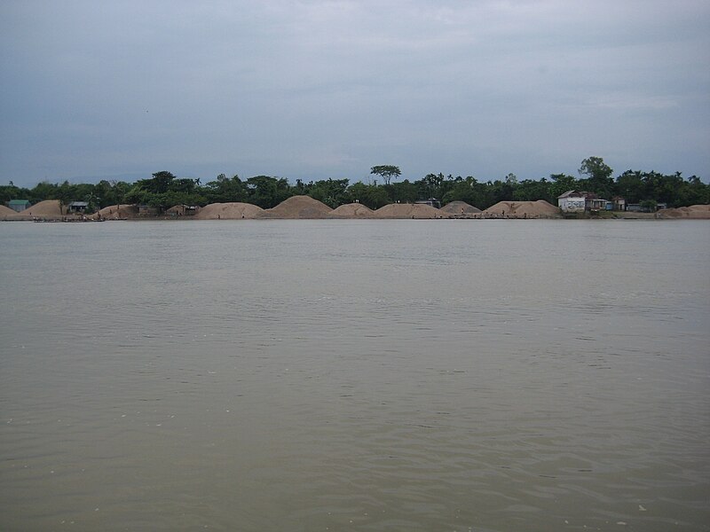


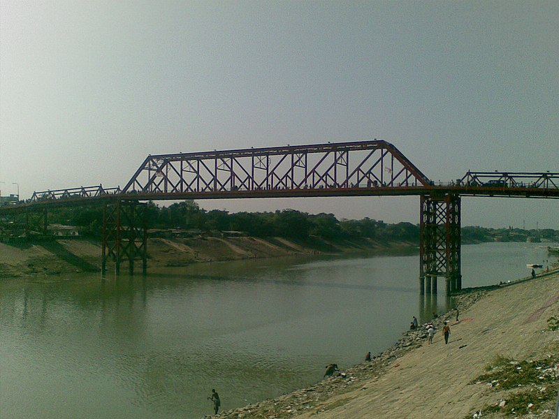
Kushiyara River

The Kushiyara River is a distributary river
in Bangladesh and Assam, India. It forms on the India–Bangladesh
border as a branch of the Barak River, when
the Barak separates into the Kushiyara and Surma.
The waters of the Kushiyara thus originate in the state of Nagaland in
India and pick up tributaries from Manipur, Mizoram and Assam.
From its origin at the mouth of the Barak, also known as the
Amlshid bifurcation point, the Kushiyara flows westward forming the
boundary between Assam, India,
and the Sylhet District of
Bangladesh. It flows between the towns of Zakigonj,
Sylhet, and Karīmganj, Assam, and after the village of Pānjipuri enters entirely into
the Beanibazar Upazila of Bangladesh. It then
flows southwestward past the village of Deulgrām in Kurar Bazar Union where
the river turns southward passing the village of Badepasha, Uttar Bade Pasha
Union, Golapganj Upazila, where it again turns
southwestward. It is joined from the left (east) by the Juri River at Fenchuganj Bazar. At Beel
Pond (Pukhuri Beel) the river turns westward where it flows past the village of
Balaganj Bazar in Balaganj Upazila, then southwestward past the
villages of Hamjāpur, Abdullāpur and Manumukh. The river, after being joined
from the left (south) by the Monu River, flows northwest past the
villages of Aorangapur, Tajpur, and Pāilgaon, where it is joined by the small
Itakhola River and assumes a westward direction. After the village of Mārkuli
the river heads southwest past the village of Pāhārpur to the village of
Ajmiriganj Bazar. After that the river forms several braided streams and heads
south where it is joined by the Khowai River from
the left (east) and heads southwest where it is rejoined by the Surma (locally
known as the Danu River) from the right (north) and becomes the Meghna River,
just north of the town of Bhairab Bazar. Altogether
the Kushiyara runs about 160 kilometers. At its deepest during the rainy
season the Kushiyara can reach a depth of 10 meters.[1] During the dry season it
can appear to dry up almost completely in a few places with the bulk of the
load being carried subsurface, such as in the braided stream area south of
Ajmiriganj Bazar.
Buriganga River
The Buriganga River (Bengali: বুড়িগঙ্গা Buŗigônga "Old Ganges") flows past the southwest outskirts
of Dhaka city, the capital of Bangladesh. Its average depth is 7.6 metres (25 ft)
and its maximum depth is 18 metres (58 ft).
History

View
looking along the river Buriganga towards the city of Dhaka situated on the
left bank. A Hindu temple tower stands at the water's edge (1885).
In the distant past, a course of the Ganges river
used to reach the Bay of
Bengal through the Dhaleshwari river. When this course
gradually shifted and ultimately lost its link with the main channel of the
Ganges it was renamed the Buriganga. It is said that the water levels during
high and very high tides in this river astonished the Mughals. In the
20th century the water table and river became polluted by polythenes and other
hazardous substances from demolished buildings near the river banks.
The course of the Padma, as the
main course of the Ganges is known in Bangladesh, changed considerably during
the period 1600 to 2000 AD. It is difficult to trace accurately the various
channels through which it flowed, but the probability is that it flowed
past Rampur Boalia, through Chalan Beel, the Dhaleshwari and Buriganga rivers,
past Dhakainto the Meghna estuary. In the 18th century, the
lower course of the river flowed further south. About the middle of the 19th
century the main volume of the channel flowed through this southern channel,
which came to be known as Kirtinasa. Gradually the Padma adopted its present
course.
Pollution
The Buriganga is economically very important to Dhaka. Launches and
country boats provide connection to other parts of Bangladesh, a
largely riverine country. When the Mughals made Dhaka their capital in 1610,
the banks of the Buriganga were already a prime location for trade. The river
was also the city's main source of drinking water.
Today, the Buriganga river is afflicted by the noisome problem
of pollution. The chemical waste of mills and factories, household waste, medical
waste, sewage, dead animals, plastics, and oil are some of the
Buriganga's pollutants. The city of Dhaka discharges about 4,500 tons of solid
waste every day and most of it is released into the Buriganga. According to
the Department of Environment, 21,600
cubic metres (5.7 million US gallons) of toxic waste are released into the
river by the tanneries every day. Experts identified nine industrial areas in
and around the capital city as the primary sources of river pollution: Tongi, Tejgaon, Hazaribagh, Tarabo, Narayanganj, Savar, Gazipur, Dhaka
Export Processing Zone and Ghorashal. Most of the industrial units of these
areas have no sewage treatment or effluent treatment plants (ETPs)
of their own.
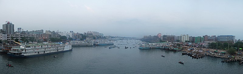
View of
Buriganga River from the bridge in Dhaka
More than 60,000 cubic metres (2,100,000 cu ft) of
toxic waste, including textile dying, printing, washing and pharmaceuticals,
are released into the main water bodies of Dhaka every day. According to the
Dhaka Water and Sewerage Authority (WASA), about 12,000 cubic metres
(420,000 cu ft) of untreated waste are released into the lake from
Tejgaon, Badda and Mohakhali industrial areas every day. The waste mostly comes
from garment washing and dyeing plants. Textile industries annually discharge as
much as 56 million tonnes of waste and 0.5 million tonnes of sludge.
Sewage is also released into the Buriganga. A newspaper article from
2004 indicated that up to 80% of Dhaka's sewage was untreated. Because of
Dhaka's heavy reliance on river transport for goods, including food, the
Buriganga receives especially high amounts of food waste since unusable or
rotting portions of fruits, vegetables, and fish are thrown into the river.
Nearly 4.0 million people of the city are exposed to the
consequences of water pollution every day.
Previously, a group of environmentalists attempted to form a
river patrolling team to save the Buriganga and other rivers from extreme
pollution. The group was concerned about the contamination of the rivers around
the capital and demanded immediate action. The government has been criticised
for its inability or unwillingness to stop the industrial units of the city
from releasing untreated waste into the water.
Photo Gallery of Buriganga
River

Large launches waiting at Sadarghat on the Buriganga for different
destinations in Bangladesh

A boatman sells pineapples at
Sadarghat on the Buriganga


Sadarghat port on the Buriganga
river is an important river transport hub

Small boats ply on the Buriganga
at Sadarghat

Land reclamation on the Buriganga
river dredges sand and deposits it on the floodplain.

A wonderful view of Buriganga
River, Dhaka, Bangladesh

Evening of Buriganga River,
Dhaka, Bangladesh
Atrai River
Atrai River (also spelt as Atreyee) (Bengali: আত্রাই/আত্রেই
নদী) flows in West Bengal and
northern parts of Bangladesh.
In ancient times the river was called Atrei and finds a mention
in the Mahabharata. It is linked with Jorapani river, Fuleswari river,
and Karatoya River.
It originates in Siliguri ward no 40, near baikanthapur forest West Bengal and
then after flowing through Dinajpur
District of Bangladesh, it enters India again.[1] It
passes through Kumarganj and Balurghat community
development blocks in Dakshin Dinajpur
district. The river then renters Bangladesh. It splits into two
rivers—the Gabura and the Kankra in Dinajpur district. It crosses the Barind Tract and flows into Chalan Beel. The river serves as a
perennial source of fishing, even
though it is often the cause of flooding in many areas during monsoons.
Total length of this river is approximately 240 miles
(390 km). The maximum depth of the river is 99 feet (30 m).
Early history

Atrai
river during monsoon, a view from Atrai Upazila, Naogaon District, Bangladesh
The Atrai was formerly one of the greatest rivers of north Bengal for
it was the main channel by which the waters of the Teesta discharged into the Ganges. In
1787, however, the Teesta broke away from its ancient bed and cut for itself a
new and capacious channel by which it found its way into the Brahmaputra. Since
then the Atrai has lost its importance and has now few traces of its former
greatness.
It enters the district from Rajshahi flowing through the Chalan Beel
and falls into the Baral near the
village of Nurnagar. Formerly, it used to pursue a course to the south and east
after leaving the Chalan Beel till it fell into the Jamuna; but the middle
portion of this old channel has been obliterated by the Baral and the Ichhamati, which, taking off from the Padma cut
across the Atrai and overwhelmed it by copious deposit of silt.
The southern portion of the river in this district can still be
traced from its junction with the Ichhamati at Boalmari; it then flows through Dulai and Bera
thana and falls into the Padma near Ratanganj. This river presents one of the
most striking instances of riverine changes in the district of Pabna.
Karnaphuli (Bengali: কর্ণফুলি Kôrnophuli; also spelt Karnafuli[1]),
or Khawthlangtuipui (in Mizo,
meaning "western river"), is the largest and most important river
in Chittagong and the Chittagong Hill
Tracts. It is a 667-metre
(2,188 ft) wide river in the south-eastern part of Bangladesh. Originating from the [[[Saitah]] village of Mamit district in Mizoram, India, it flows
270 kilometres (170 mi) southwest through Chittagong Hill Tracts and
Chittagong into the Bay of Bengal. It is said to "represent the drainage system of the
whole south-western part of Mizoram."Principal tributaries include
the Kawrpui River or Thega River, Tuichawng River and Phairuang River. A large hydroelectric power plant using Karnaphuli river was built in
the Kaptai region during the 1960s. The mouth of the
river hosts Chittagong's sea port, the main port of Bangladesh.
Chittagong City
Chittagong is situated on the banks of the Karnaphuli River
between the Chittagong Hill Tracts and the Bay of
Bengal. The city is a noteworthy seaside seaport city and monetary
focus in southeastern Bangladesh. The Chittagong Metropolitan Area has a populace
of more than 6.5 million, making it the second biggest city in Bangladesh. It
is the capital of an eponymous locale and division. A water treatment plant has
been set up by Chittagong Port Authority to
source water from the Karnaphuli river for its uses. The plant will make the
port self-reliant in its water needs.
Transportation

New
Karnaphuli Bridge
The Government has awarded a contract to build a two lane Karnaphuli tunnel underneath the Karnaphuli
river to China Communication Construction Company (CCCC). This will be the
first underwater tunnel in Bangladesh. CCCC will receive $706 million for its
services with total costs expected to be over $1 billion.
Aquatic life
The river is home to Ganges river dolphin, which is an endangered species.
Hilsa used
to be common in the river, but have nearly disappeared from the river due to
pollution.
Kaptai dam

Kaptai
Lake on Karnaphuli River
The Kaptai Dam is
the location of the Karnafuli Hydroelectric Power Station, constructed in
Kaptai in 1962 and the only hydro-electric power
plant in the country. An earth-filled dam on the Karnaphuli River, the Kaptai
Dam created the Kaptai Lake,
which acts as the water reservoir for the hydropower station. The power plant
produces a total of 230 megawatts of electricity.When then east Pakistan built
the dam, Indian Prime Minister Jawaharlal Nehru didn't object even though it
resulted in part of Indian side getting submerged and inflow of more than 40000
refugees.
Pollution
Like many rivers in Bangladesh, Karnaphuli is heavily polluted
by agricultural runoff. Reducing the amount of oxygen available and harming
aquatic life in the river. In 2015, a train carrying oil crashed over a tributary
of the river. The spill caused environmental degradation.
Gallery

Boat on Karnaphuli River

View of the river

Ships at Karnaphuli River

Port of Chittagong and Karnaphuli River at
night
Baral River
Baral (Borhal Bengali: বড়াল) river
is one of the offshoots of the Ganges, starts
its journey at Charghat Upazila of Rajshahi District of Bangladesh. The
Baral flows through Natore and Pabna meets
with the Gumani River at
the east of Bhangura and finally
meets with the Hurasagar River after
joining with the Karatoya south
of Shahjadpur Upazila.
The river is approximately 147 kilometres (91 mi) long, and 120 metres
(410 ft) wide and 6 metres (20 ft) deep on average. The river
receives water from the Ganges only in the monsoon season.
But it maintains its flow throughout the year with local runoff water and water
from Chalan Beel. Its
drainage area is about 230 square kilometres (89 sq mi). Some
important places located on the banks of the Baral are: Charghat, Baraigram,
Bagatipara, Gurudaspur, Chatmohar, Bhangura and Bera upazilas of
Bangladesh. The Baral Bridge is located on this river
at Bhangura Upazila.
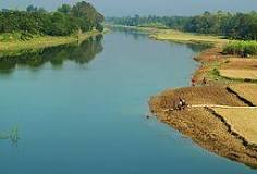
Early history
The Baral also issues from the Padma at
Charghat in the Rajshahi district
and receives the water of the Atrai through the channel called the
Gumani shortly after it enters the district of Pabna.
It flows through the northern part of the Sadar subdivision, passing by the large village of
Chatmohar, the headquarters of the Chatmohar subdistrict, and continue its course
to south-east.
The Baral meets the Gumani (an extension of Atrai) near the
village of Faridpur in
Pabna District (not to be confused with the district headquarters of Faridpur
District). The combined waters join the Hurasagar River, south of Shahjadpur Upazila.
Eighteenth-century geographer James Rennell referred to a former
course of the Ganges north of its present channel, as follows:
"Appearances favour very strongly that the Ganges had its
former bed in the tract now occupied by the lakes and morasses between Natore
and Jaffiergunge, striking out of the present course by Bauleah to a junction
of Burrrampooter or Megna near Fringybazar, where accumulation of two such
mighty streams probably scooped out the present amazing bed of the Megna."
The places mentioned by Rennell proceeding from west to east are
Rampur Boali, the headquarters of Rajshahi district, Puthia and Natore in the
same district and Jaffarganj in the district of Dhaka. The place last named
were shown in a map of the Mymensingh district dated 1861, as a subdistrict
(thana) headquarters, about 10 kilometres (6 mi) south-east of Bera
Upazila police station. It is now known as Payla Jaffarganj and is close to
Elachipur opposite Goalunda. According to Rennell's theory, therefore, the
probable former course of the Ganges would correspond with that of the present
channel of the Baral River.
Dhaleshwari River
The Dhaleshwari River (Bengali: ধলেশ্বরী Dhôleshshori)
is a distributary, 160
kilometres (99 mi) long, of the Jamuna River in central Bangladesh. It
starts off the Jamuna near the northwestern tip of Tangail District.
After that it divides into two branches: the north branch retains the name
Dhaleshwari and merges with the other branch, the Kaliganga River at the
southern part of Manikganj District. Finally the merged flow
meets the Shitalakshya River near Narayanganj District. This combined flow goes
southwards to merge into the Meghna River.

Average depth of river is 122 feet (37 m) and maximum depth
is 265 feet (81 m).
The Dhaleshwari is a branch of the Jamuna but probably used to
be part of the main course of the Padma. The
course of the Padma has changed considerably during the period 1600 to 2000 AD.
It is difficult to trace accurately the various channels through which it has
flowed. The probability is that it flowed past Rampur Boalia, through Chalan Beel,
the Dhaleshwari and Buriganga rivers, past Dhakainto the Meghna estuary.
In the 18th century, the lower course of the river flowed further south. About
the middle of the 19th century the main volume of the channel flowed through
this southern channel which came to be known as Kirtinasa. Gradually the Padma
adopted its present course.
Gorai-Madhumati River
 .
.
Pasur River
The Pasur River is a river in southwestern Bangladesh and a distributary of the Ganges. It continues the Rupsa River. All its distributaries are tidal. It meets the Shibsa River within the Sundarbans, and near to the sea the river becomes the Kunga River. It is the deepest river in Bangladesh.

Shitalakshya River
Shitalakshya River (Bengali: শীতলক্ষ্যা
নদী pronounced: Shitalokkha Nodi) (also known
as Lakhya River) is a distributary of
the Brahmaputra. In its
initial stages it flows in a southwest direction and then east of the city
of Narayanganj in
central Bangladesh until
it merges with the Dhaleswari near
Kalagachhiya. A portion of its upper course is known as Banar River. The river
is about 110 kilometres (68 mi) long and at it widest, near Narayanganj, it
is 300 metres (980 ft) across. Its flow, measured at Demra, has reached 74
cubic metres per second (2,600 cu ft/s). It remains navigable
year round. The river flows through Gazipur district forming its border
with Narsingdi for some distance and then
through Narayanganj District.
The river's maximum depth is 21 metres (70 ft) and average
depth is 10 metres (33 ft).
Change in course of rivers
The Shitalakhya is a branch of the Brahmaputra which has changed
its course at least twice in the Bangladesh region in the fairly recent past,
indirectly affecting the flow of water in the Shitalakhya. In the 21st century,
the main flow of the Brahmaputra waters is through the Jamuna channel.
Earlier, after tracing a curve round the Garo
Hills on the west, it took a sharp turn in the south-east
direction near Dewanganj, and
then passing by Jamalpur and Mymensingh, threw off the Shitalakhya branch
and flowed through the eastern part of Dhaka district and fell into the Dhaleshwari. The Shitalakhya ran almost
parallel to the Brahmaputra and after passing by Narayanganj joined the Dhaleswari. The
course of the Brahmaputra through Dhaka district was deserted by the 18th
century when it flowed further east and joined the Meghna near Bhairab. Towards the end of the 18th century
the Jamuna channel increased its importance and around 1850 it became the main
channel of the Brahmaputra.
In Van den Brouck's map the river is marked as Lecki, flowing
west of Barrempooter (Brahmaputra). In Van den Brouck’s time (1660), it was
large and swift flowing river. It was so till the early 19th century. There,
however, are some reservations about the accuracy of Van den Brouck’s map.
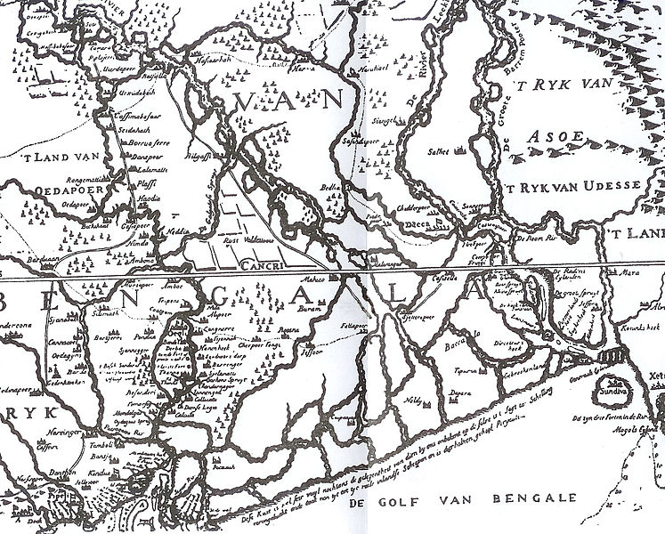
Van den
Brouck’s map of 1660
Historical importance
Sonargaon, a former capital of the region, stood on
the banks of the Shitalakhhya. A fort was built by Isa Khan, a
former ruler of the area, on its banks. It is believed that it was connected
with Lalbagh Fort in Dhaka through
an underground tunnel. Sonakanda Fort, also on the river, was built
to counter Magh and Portuguese pirates. There are several historical mosques on
its banks – Bandarshahi mosque (built in 1481 by Baba Saleh), Kadam Rasul mosque (containing the
footprints of Hazrat Mohammad),
Mariamer masjid (built by Shaista Khan) etc.
Economic importance
The Shitalakshya River was once an important center for
the muslin industry. Even
today, there are centres of artistic weaving on its banks. There also are a
number of industrial units on its banks, including the Adamjee Jute Mills.
Thermal power houses are located along the river at Palash (north of Ghorashal)
and at Siddhirganj.
Industrial affluent dumped into the river resulting in high levels of pollution
is a cause for concern.
Portion of
a sari woven on the banks of Shitalakshya River
There is a river port in Narayanganj. Numerous
launches move out along the river to different parts of Bangladesh. The
government has approved construction of a container terminal on the river
Shitalakhya with foreign investment.
Sangu River
The Sangu River is a river in Myanmar and Bangladesh. Its
source is in the North Arakan Hills of Myanmar, located
at 21°13´N 92°37´E. The Arakan Hills form the boundary between Arakan and
the Chittagong Hill Tracts. It
follows a northerly circuitous course in the hill tracts and then enters Bangladesh near
Remarki, Thanchi Upazila, Bandarban District, from the east. It flows
north through Thanchi, Rowangchhari and Bandarban Sadar Upazilas of Bandarban
District. It then flows west through Satkania and Banshkhali Upazilas in Chittagong District and
flows into the Bay of Bengal near Chittagong, at
22°6´N 91°51´E, or about 16.09 kilometres (10.00 mi) south of the mouth of
the Karnafuli River. The length of the river is 270
kilometres (170 mi); 173 kilometres (107 mi) are located within Bangladesh.

The major tributaries of the river are the Chand Khali Nadi and
Dolukhal. The Chand Khali Nadi flows through the Patiya Plains, and the
Dolukhal River drains into the Satkania Plains. Another tributary is the Kumira
Khali, which drains into the Kutubdia Channel. There are seven Bangladesh Water
Management Board hydrometric stations on this river, which have been recording
data since 1965.
The Sangu drains off the waters of Patiya,
Satkania, and Banshkhali Upazilas. It has a connection with
the Karnafuli River through the Chand Khali
River. The Sangu is a shallow river, but it becomes violent during rains and
develops rapid currents. It is navigable up to 48.27 kilometres (29.99 mi)
from the estuary. The Sangu gas field is located about 50 kilometres
(31 mi) southwest of Chittagong and
reaches a depth of 10 meters at its mouth.
Mahananda River
The Mahananda River (Pron:/ˌməhɑːˈnʌndə
or ˌmɑːhəˈnʌndə/) (Nepali: महानदी, Hindi: महानन्दा नदी, Bengali: মহানন্দা নদী) is a trans-boundary
river that flows through
the Indian states of West Bengal, Bihar,
and Bangladesh. Its right bank tributary, the Mechi Riverforms part of Nepal's eastern
boundary with West Bengal while the Kankai flows
out of Nepal.
Course

Mahananda
river- view from captain mohiudding jahangir( bir shreshtha) bridge at
Nawabganj district
The Mahananda originates in the Himalayas:
Paglajhora Falls on Mahaldiram Hill near Chimli, east of Kurseong in Darjeeling district at an elevation of 2,100
metres (6,900 ft). It flows through Mahananda Wildlife
Sanctuary and descends to the plains near Siliguri. It touches Jalpaiguri district.
It enters Bangladesh near Tentulia in Panchagarh District,
flows for 3 kilometres (1.9 mi) after Tentulia and returns to India.[5] After
flowing through Uttar Dinajpur district in West Bengal and Kishanganj and Katihar districts in Bihar, it enters Malda district in West Bengal. The
Mahananda divides the district into two regions — the eastern region,
consisting mainly of old alluvial and relatively infertile soil is commonly
known as Barind (Borendrovomee), and the western region,
which is further subdivided by the river Kalindri into two areas, the northern
area is known as "Tal". It is low-lying and vulnerable to inundation
during rainy season; the southern area consists of very fertile land and is
thickly populated, being commonly known as "Diara".
Basin data
The total length of the Mahananda is 360 kilometres
(220 mi), out of which 324 kilometres (201 mi) are in India and
36 kilometres (22 mi) are in Bangladesh.
The total drainage area of the Mahananda is 20,600 square
kilometres (8,000 sq mi) out of which 11,530 square kilometres
(4,450 sq mi) are in India.
Tributaries
The main tributaries of the Mahananda are Balason, Mechi, Ratwa, Kankai. In the Siliguri area it has three tributaries
called the Trinai, Ranochondi and the pair of Chokor and Dauk taken as a single
tributary.
History
The Kosi (Kausiki),
which flows through the northeastern Bihar and
joins the Ganges at a point much higher up than Rajmahal, originally ran eastward and fell into the
Brahmaputra. The channel of the Kosi, therefore, must have been steadily
shifting toward the west, right across the whole breadth of North Bengal. There
was a time when the Kosi and the Mahananda joined the Karatoya and formed a sort of ethnic boundary
between people living south of it and the Kochs and Kiratas living north of the river.
Dharla River
The Dharla River ([ধরলা নদী, Dhorola
nodi] is one of Bangladesh's trans-boundary rivers. It originates in the Himalayas where
it is known as the Jaldhaka River,
and then it flows through the Jalpaiguri and Cooch Behar districts of West
Bengal, India, one of the seven main rivers to do so. Here the river enters
Bangladesh through the Lalmonirhat District and
joins with the Jaldhaka River and flows as the Dharla River until it empties
into the Brahmaputra River near the Kurigram District. Near Patgram Upazila, it again flows easternly back
into India. It then moves south and enters Bangladesh again through Phulbari Upazila of
Kurigram District and continues a slow meandering course.

The average depth of river is 12 feet (3.7 m) and maximum
depth is 39 feet (12 m), in origin of Kurigram.
Erosion by the rivers Dharla and Jamuna took a serious turn in
Lalmonirhat in 2007. In Lalmonirhat, about 2 kilometres (1.2 mi) of a
7-kilometre (4.3 mi) long flood control embankment was devoured by the
Dharla. Three mosques, two temples, a madrassah and a primary school, and a
vast tract of cultivable land with crops were devoured by the river, rendering
about three thousand people homeless.
There is a park beside the Dharla at Kurigram. There also is a
bridge. The river is full during the monsoon season
but has only knee-deep water in summer. Deposition of silt has led to the
formation of many small islands (chars) in the river.
Khowai River
Khowai River is a trans-boundary river that originates in the eastern part of
the Atharamura Hills
of Tripura in India. Flowing north-north-west, it leaves India
at Khowai, and enters Bangladesh at Balla in Habiganj
District.

The river passes east
of Habiganj town, where it is under pressure from
encroachment and pollution. North of town it turns west, and joins the Kushiyara near Adampur in Lakhai
Upazila, Kishoreganj District.
Muhuri River
Muhuri is a transnational river between India and Bangladesh. Rising in Tripura, it flows into Bangladesh where it merges with
the Feninear the
latter's mouth to the Bay of
Bengal. The Muhuri is also known
as the Little Feni.

Punarbhaba River
The Punarbhaba (Poonorvoba Bengali: পুনরভবা নদী) is a river
of Bangladesh and West
Bengal, of total length about 160
kilometres (99 mi) and a width of 3 to 8 kilometres (1.9 to 5.0 mi)
and a mean depth of 1.96 metres (6.4 ft) It originates from the lowlands
of Thakurgaon District of Bangladesh. The river's upper part is a few
kilometres west of Atrai. Dinajpur town of Bangladesh is situated on the
east bank of the river. It flows through Gangarampur and Tapan community
development blocks of Dakshin Dinajpur district of West Bengal. After flowing to the
south, this river meets with the Dhepa
River. Ultimately it flows into
the Ganges.

Karatoya River
Karatoya River (also spelt Korotoa River) (Bengali: করতোয়া নদী), a small stream in Rajshahi Division of Bangladesh, was once a large and sacred river. A channel of it
presently flows by the ancient ruins of Mahasthangarh (or Pundranagara, ancient capital of Pundravardhana) in Bogra District. The Karatoya mahatmya bears
testimony to its past greatness. In the Mahabharata it is mentioned that a visit to the
Karatoya after three days’ fast produces the same merit as an aswamedha (horse
killing) sacrifice. Another ancient city, Sravasti,
may have been located on the banks of the Karatoya, north of Mahasthangarh.
However, there is a controversy about the possible location of Sravasti.
Early history
The Karatoya, known as Phuljhur rises in the Baikunthapur
jungles in the extreme north-west of Jalpaiguri district (West Bengal, India)
and forms for some distance the boundary between Dinajpur and Rangpur
districts. It, then, meanders through Rangpur and Bogra. In the south of Bogra
district, it receives the Halhalia and the united stream is then known as
Phuljhur. It leaves Bogra at Chanda kona and flowing in a southerly direction
past Raiganj and Shujapur is joined by the Ichhamati at Nalka. The Phuljhur then flows
south past the important village of Ullapara, a few miles below which it joins
the Hurasagar at
Narnia after a course of about 64 kilometres (40 mi) in this district.
After this junction, it takes the name of Hurasagar and passing close by
Shazadpur and Hera joins the Jamuna near Bera.
The Karatoya is mentioned in the Puranas and had a high repute
for sanctity. It was the eastern boundary of the old kingdom of
Paundravardhana, the country of the Paundras which it separated from Kamrupa.
It is shown in Van Den Brouk's map of Bengal (C, 1660) as flowing into the
Ganges and in fact. before the destructive floods of 1787 it brought down to
the Atrai and to the Ganges a great volume of Teesta water. Since the main
stream of the Teesta was dirverted to the east in 1787, the Karatoya and the
Phuljhur have gradually silted up. and they are at the present day rivers of
minor importance. One channel, which joins the Baral, 48 kilometres
(30 mi) east of Pabna. is still called indifferently the Buri Teesta or
old Teesta and the Karto or Karatoya. Traces of an old channel, for which the
name of the Karatoya is claimed, are also pointed out in the Chatmohar thana,
where it appears to have been obliterated by the Baral.
Etymology
The name of the river is formed of two Bengali words kar (hand)
and toa (water), signifying, in Hindu mythology, that the
river was formed by the water which was poured on the hands of Shiva, when he
married Parvati.
Changes in the course of rivers
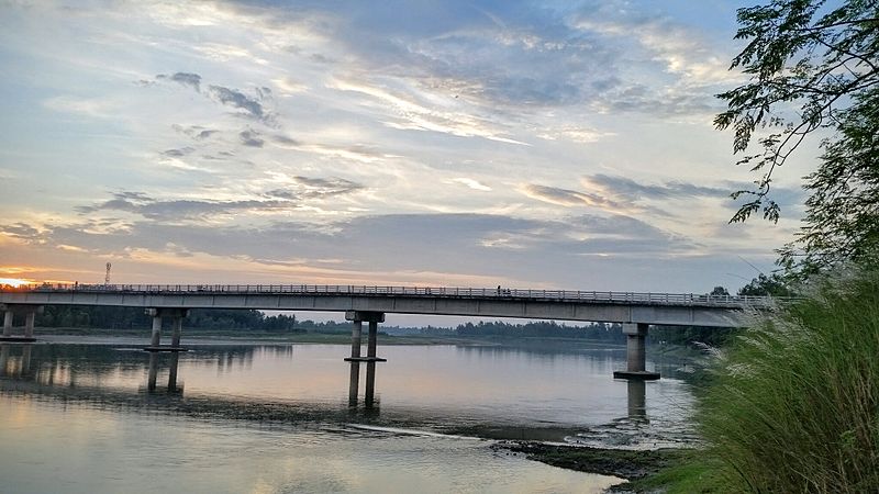
Dr. M A
Wazed Miah bridge over Karatoya river in Kanchdaha, Rangpur.
Great changes have taken place in the course of some of the
rivers in Bengal and the adjoining areas, during the period since 1500 AD.
Although positive evidence is lacking, similar changes can be assumed in the
remoter past. The Karatoya is one of the rivers that has changed over the
years.
The map (right) shows the main rivers in North Bengal and
adjoining areas. Not shown are numerous tributaries and distributaries, which
connect the main rivers, and allow the main rivers to change course. Therefore,
the river-system pattern undergoes continuous changes. Such changes have not been
reflected in the map. Moreover, many of the rivers have local names for
sections of the course, adding to the complexity of the river system.
Tectonic disturbances have broken up the Karatoya into four
distinct parts. The northern part, called the Dinajpur-Karatoya, is the main
source of the Atrai. It rises
in a marsh in Baikanthapur in Jalpaiguri district, but also receives water
from underground streams. In Khansamaupazila its name changes to
Atrai. In a second section, the Dinajpur-Karatoya was connected with the
Rangpur-Karatoya north of Khansama, but very little water now passes down that
channel. The upper part of Rangpur-Karatoya originates in the Jalpaiguri
district and is known as the Deonai-Jamuneshwari up to Gobindaganj upazila.
In a third section, the Jamuneshwari-Karatoya flows south-southeast to Gobindaganj upazila,
where the main stream turns east through the Katakhali and
falls into the Bangali River.
The portion of the former river passing through Shibganj upazila
is dry most of the year. It effectively separates the Rangpur-Karatoya from the
Bogra-Karatoya, which flows south past Bogra town till it joins the Bangali to
make Phuljhor river, which falls into the Hoorasagar. The fourth part, the
Pabna-Karatoya, is a moribund river bed near Handial.
Various other channels are also pointed out as parts of the Old Karatoya.
Teesta
Van den
Brouck’s map

Rennel’s
map
The Teesta earlier
ran due south from Jalpaiguri in
three channels, namely, the Karatoya to the east, the Punarbhaba in the west and the Atrai in the centre. The three channels possibly
gave the name to the river as Trisrota (possessed of three streams) which has
been shortened and corrupted to Teesta. Of these three the Punarbhaba joined
the Mahananda. The
Atrai passing through a vast marshy area known as Chalan Beel joined the Karatoya and the united
stream joined the Padma near
Jafarganj. In the destructive floods of 1787, the Teesta forsook its old
channel and rushing south-east it joined the Brahmaputra.
In the Siyar-al-Mutakhkhirin it is recorded
that the Karatoya was three times the size of the Ganges when Bakhtiyar
Khilji invaded the northern parts of Bengal in 1115. In Ven den
Brouck's map of Bengal, prepared in 1660, the Karatoya is shown as a large
channel.Rennel made a survey between 1764 and 1777 and his maps are one of the
earliest authentic maps of Bengal in existence. In these maps Teesta is shown
as flowing through North Bengal in several branches—Punarbhaba, Atrai, Karatoya
etc. All these streams combined lower down with the Mahananda, now the
westernmost river in North Bengal, and taking the name of Hoorsagar finally
discharged into the Ganges at Jafarganj, near modern Goalundo. The Hoorsagar
river is still in existence being the combined outfall of the Baral, a spill channel of the Ganges, the Atrai, the
Jamuna or Jamuneswari (not the main Jamuna through which the Brahmaputra now
flows), and the Karatoya, but instead of falling into the Ganges, it falls into
the main Jamuna, a few
miles above its confluence with the Padma at Goalundo.
Kosi
The Kosi (Kausiki),
which now flows through the north-eastern Bihar and
joins the Ganges at a point much higher up than Rajmahal, originally ran eastward and fell into the
Brahmaputra. The channel of the Kosi, therefore, must have been steadily
shifting towards the west, right across the whole breadth of North Bengal.
There was a time when the Kosi and the Mahananda joined the Karatoya and formed
a sort of ethnic boundary between people living south of it and the Kochs and Kiratas living north of the river.
Kaliganga River

Early history
The Kaliganga takes off from the Garai just below the Kushtia town
and flows straight to the south and enters Jhenaidah subdivision (now district). The
mouth of this river is blocked by an embankment of the railway line to Goalundo, providing an alternate mouth further
below.
Turag River
The Turag River (Bengali: তুরাগ নদী [t̪uraɡ nɔd̪i]) is the upper tributary of
the Buriganga, a major river in Bangladesh. The
Turag originates from the Bangshi River,
the latter an important tributary of the Dhaleshwari
River, flows through Gazipur and
joins the Buriganga at Mirpur in Dhaka District. It
is navigable by
boat all year round.
The Turag suffers from infilling along
its banks, which restricts its flow. It also
suffers from acute water pollution. While
attempts have been made to marginally widen the river, the majority of
industry has made little effort to follow environmental law and the water
has become visibly discolored.

History
Earlier this river was called as (Bengali: "Kohor
Doriya"), "Kohor river".
Religious significance
Tabligh Jam'at, a popular Islamic movement
originating in South Asia, initially took hold in Dhaka in the 1950s
as Maulana Abdul Aziz and other leaders set up the regional headquarters at
the Kakrail Mosque near Ramna Park. An initiative of the movement is
an emphasis on the six uṣūl or "basic principles,"
two of which include ilm, the pursuit of knowledge, and dhikr or zikr,
a method of prayer involving repetitive invocation of hadith and Qur'an passages.
To this end, the movement places importance on ijtema or
assembly, where members gather to practice and participate in dhikr,
hear religious sermons and discuss their activities.
The largest of these, the Bishwa Ijtema, is situated by the Turag River
in Tongi and attracts estimates of between two and four million Muslims annually
as well as representatives from over sixty countries, making it the second
biggest Islamic congregation after the Hajj.
Bangshi River
Bangshi River (also spelt Bansi) (Bengali: বংশী নদী) is an
important river in central Bangladesh. It
originates in Jamalpur, from
the course of the old Brahmaputra and
flows past the Madhupur tract. It
flows through Tangail and
meets the Tongi in Ghazipur. It
passes near Jatiyo Smriti Soudho in Savar and falls into the Dhaleshwari. About
238 kilometres (148 mi) long, it is not navigable for most of the year
except when swelled by the rains of the monsoon.

Louhajang is
a tributary of the Bangshi
The river's average depth is 30 feet (9 m) and maximum
depth is 80 feet (24 m).
Turag-Bangshi River basin
A report on wetland protection and enhancement says, “The Turag-Bangshi
floodplain is located in Kaliakair
Upazila of Gazipur
District. Upstream the basin is connected via the Dhaleswari-Pungli
River to the greater Jamuna floodplain, and downstream
it is connected through the Tongi River with the Buriganga-Meghna
River system. The Upper Turag-Lower Bangshi is the main source
of water in the region and flows through the site. All associated beels and
other floodplain areas are connected to the main river through a series of
khals and other channels. This is a deeply flooded area in the low-red soil
plateau of Madhupur tract. The floodplain is inundated when water flows over
the banks of the Turag-Bangshi river making all the low areas become a
connected sheet of water in the monsoon. By late November, most of the water
recedes and boro rice is planted in almost all of the low-lying areas. During
the rainy season the water area is about 43 km² while in the dry season
the water area becomes less than 7 km². About 2,68,900 people live in this
area with 84% of households being involved in fishing, and 15 % of
households are full time fishers.
A bazar nayar hat situated at bank while the famous pottery
village pal para is also situated on south side of Bangshi.
Bishkhali River
Gumti, Gomti, Gumati or Gomati (Bengali: গোমতী, gomtī/gomôtī) is a river flowing through the north-eastern Indian state of Tripura and Bangladesh. A dam has been constructed near Dumbur on the river that has formed a lake covering 40 square kilometres (15 sq mi).

Mathabhanga River
The Mathabhanga River (Bengali: মাথাভাংগা
নদী) is a transboundary river between India and Bangladesh.

Early history
The Mathabhanga or Hauli,
whose lower reach is called the Haulia,
leaves the Padma about ten miles below the point where the Jalangi leaves from it.
It flows first in a southeasterly direction as far as Hatboalia, where it bifurcates one branch, which is thereafter known as the Kumar or Pangasi, it then proceeds in the same direction, past Alamdanga, up to the boundary of the district which it forms for a few miles until it passes into Jessore, whilst the other branch pursues a very tortuous course. The general trend of which is to the south, until, after passing Chuadanga it reaches Krishnaganj (in India). There a second bifurcation takes place, the two resulting streams being known as the Churni and the Ichamati, and the name of the parent river being lost. It borderline's between India and Bangladesh.
It flows first in a southeasterly direction as far as Hatboalia, where it bifurcates one branch, which is thereafter known as the Kumar or Pangasi, it then proceeds in the same direction, past Alamdanga, up to the boundary of the district which it forms for a few miles until it passes into Jessore, whilst the other branch pursues a very tortuous course. The general trend of which is to the south, until, after passing Chuadanga it reaches Krishnaganj (in India). There a second bifurcation takes place, the two resulting streams being known as the Churni and the Ichamati, and the name of the parent river being lost. It borderline's between India and Bangladesh.
Naf River
The Naf River (Burmese: နတ္ျမစ္ [naʔ mjɪʔ]; Rakhine: နတ္ျမစ္ [nɛ́ mràɪʔ]; Bengali: নাফ নদী Naf
Nodi IPA: [naf nod̪i])
is an international river marking the border of southeastern Bangladesh and western Myanmar.

Geography
The Naf River's average depth is 128 feet (39 m), and
maximum depth is 400 feet (120 m).
It flows into the Bay of
Bengal in the Indian
Ocean, between the Bangladeshi Cox's Bazar District of the Chittagong Division, and the Burmese Rakhine State.
Historically, Shapuree Island, located at the mouth of the
river, has played an important role territorially. It is considered as one of
the immediate causes for the first Anglo-Burmese
War. St. Martin's Island is also at the river's
mouth.
River incidents with fishermen
& refugees
Regular incidents in which fishermen and Burmese refugees are
shot by the Tatmadaw (Myanmar
Armed Forces), and/or refugees are escorted back to Myanmar by Bangladeshi
troops have occurred on the Naf River.
These include but are not limited to the following events:
These include but are not limited to the following events:
·
February 1992 — The Lun Htin,
A Burmese paramilitary force, killed 20 refugees who were
crossing the Naf River to Bangladesh.
·
24 March 1994 — Members of the Myanmar
Army's Western Military Command patrolling the Naf River found a
group of RohingyaMuslims fishing from a small country
boat. The soldiers tried to extort money from the fishermen, but when they were
unable to do so, tied them up with rope and brought them to Balu Khali village in Maungdaw
Township. Eight of the Rohingya fishermen were interrogated and tortured
for five days, and then they were all shot by firing squad.
·
27 October 2001 — Burmese border troops killed one Bangladeshi
man, wounded 2, and abducted 13 while they were fishing in the Naf River.
·
22 January 2005 — 70 people were shot and killed when Burmese
border guards opened fire on a group of 50 boats attempting to cross the Naf
River. The border guards claimed that they believed the boats contained
"smuggled rice," implying that their actions, culminating in the mass
shooting of unarmed people, were justified.
·
June 2012 — thousands of Rohingya Muslims fleeing sectarian
violence in Rakhine State sought
refuge across the Naf River in the Chittagong Division of Bangladesh, they were
often escorted back by Bangladeshi troops. On 11 July 2012, Burmese
President Thein Sein suggested expelling the Rohingya people
from Myanmar or having the UN relocate
the 300,000 Rohingya people living in Myanmar, a policy the UN quickly
rejected.
·
August 2017 — The Border Guard Bangladesh station chief of the
Ghumdum border post in Bangladesh accused Myanmar's military of firing on
fleeing Rohingyas crossing the Naf River. An AFP reporter counted more than a dozen mortar shells and
several heavy machine gun rounds fired by Burmese security forces on fleeing
Rohingyas.
Halda River
Halda River is a river in south-eastern Bangladesh. It
originates at the Badnatali Hill Ranges in Ramgarh Upazila in
the Chittagong Hill Tracts, flows
through Fatikchhari Upazila, Bhujpur Thana, Hathazari
Upazila, Raozan Upazila and Chandgaon Thana of
the Chittagong Metropolitan City, and falls into the Karnaphuli River.
The 81-kilometre (50 mi) long river has a very turbulent tributary, the
Dhurung River, which joins Purba Dhalai about 48 kilometres (30 mi)
downstream. The river is navigable by big boats 29 km into it (up to Nazir Hat)
and by small boats 16–24 km further (up to Narayanhat).
The Halda reaches up 21 feet (6.4 m) in depth and 30 feet (9.1 m) in
deepest point.

The Halda river is also famous for breeding pure Indian carp. This is
the only pure Indian carp breeding field of Bangladesh, perhaps in South Asia.
Bura Gauranga River
The Bura Gauranga River and sea channel are located in the Patuakhali district of Barisal Division in Bangladesh.

Ichamati River
Ichamati River (Bengali: ইছামতি নদী)(also spelt Ichhamati), is a trans-boundary
river which flows
through India and Bangladesh and also forms the boundary between the two countries.
The river is facing the problem of siltation leading
to thin flow of water in the dry season and floods in the rainy season. Experts
are handling the situation and remedial matters are being discussed between the
governments of India and Bangladesh.
Ichamati flow
Ichamati River is now in three parts: (1) The longer part flows
from the Mathabhanga River, a distributary of
the Padma, and after flowing for 208 kilometres (129 mi) joins the
Kalindi River near Hasnabad in North 24
Parganas and Debhata in Satkhira District. (2) Once the main river west of
Dhaka and (3) Ichamati of Dinajpur. Rennel’s map of
1764–66, shows the last two rivers as one. According to a number of
hydrologists, the three Ichamati rivers, in the past, were a single channel.
The second river marked above originates south of Jafarganj opposite to the
mouth of the Hoorsagar near Nathpur factory and runs towards Joginighat
in Munshiganj.
Joginighat is situated at the confluence of the Jamuna and
the Ichamati. There are five pilgrimage ghats along
the river locally known as Panchatirtha ghats—Tirthaghat, Agla, Solepur,
Barunighat and Joginighat.
Lower Ichamati
The Mathabhanga River originates from the rightbank of the
Padma, at Munshiganj in Kushtia
District in Bangladesh. It bifurcates near Majidia in Nadia
District in India, creating two rivers, Ichamati and Churni. After traversing a length of 19.5 kilometres
(12.1 mi) in India, the Ichamati enters Bangladesh near Mubarakpur. It
flows for 35.5 kilometres (22.1 mi) in Bangladesh and again enters India
at Duttaphulia in Nadia district. It forms the international border between
India and Bangladesh for 21 kilometres (13 mi) from Angrail to Kalanchi,
and again from Goalpara to the Kalindi-Raimangal outfall
into the Bay of Bengal.
The Bhairab once flowed from the Ganges, across the present beds
of the Jalangi, and
further eastwards towards Faridpur. The Bhairab is no more a very active river.
The Mathabhanga is a younger stream than Jalangi and it was not till very
recently that the river completed its junction with the Hooghly by adopting the
River Churni (now its lower reaches) for its main course. Earlier most of the
water of the Mathabhanga ran off to the east down the Kumara, Chitra, Coboduk
(Bhairab), and Ichamati, but all these escape routes have been shut off, except
a small amount for the Ichamati. The point to note is that while earlier the
rivers in the region flowed in a south-easterly direction, but later some force
pulled the Jalangi and the Mathabhanga in a south-westerly direction. The inference
is that it occurred because of a local subsidence, which was active for some
period prior to 1750 and which has since become inactive.
River bed raised

Ichamati
river at Basirhat city
While the bed of the Ichamati river is 4.3 metres (14 ft)
higher than that of the Mathabhanga, that of the Churni is lower than
Mathabhanga by 15 centimetres (6 in). During the lean period the level of
water in the Mathabhanga is higher than that of the Padma. As a result, no
water enters the Ichamati during the dry season. One of the causes of silting
of the river was construction of guard wall for railway over bridge. The river
beds in the area need to be excavated in order that there is flow of water during
the lean season. Since this is required to be done both in India and
Bangladesh, there is need for accord on this point. The matter has been
discussed at the ministerial level, the area surveyed to have better idea of
the problems of the people in the affected area, and decisive action is
expected in the near future.

The
Ichamati from Taki-Saidpur
The ashes
of so many burnt bodies have been carried by the river to the blue ocean
illimitable. The man who expected so much return from his plantain trees on the
southern side of that green, and at the bend of the river put bamboo traps to
catch fish, is lying today on the bank of the Ichhamati – only his white bones
remain, bleached by sunrays. So many young girls came to the river for water,
and as they grow old their footprints are lost… during ceremonies of marriage,
of making the child taste rice for the first time and of investing with the
holy thread, the festivals of Durgpuja, Luxmipuja… those ladies of so many
families pass away unnoticed… who knows when death may embrace us? Like a
deceptive guide Death accompanies us at every bend of life and then suddenly,
mysteriously he reveals his real character to a child, to an old man, perhaps…
one listens to the music of eternity when one spots the old flowers or smells
the pungent fragrance of herbal plants in Autumn. Some can visualise and dream
the unlimitable unknown eternity in the image of the Ichhamati river during the
turbulent rainy season.

Ichamati
River at Bangaon town
The river zone also faces the problem of industrial pollution
and forcible occupation of land by people. Arresting environmental hazards
resulting from lack of sanitation facilities, encroachment, groundwater
contamination like arsenic pollution, destruction of aquatic flora, fauna are
some of the burning problem of the areas that needs to be tackled through
participatory mechanism.
Ichhamati river and its branches form a large oxbow lake complex
near Bangaon in North 24-Paraganas district. Besides
agricultural and anthropogenic stresses, weed infestation particularly
with water hyacinth (Eichhornia crassipes)
is a major concern because it is covering the surface of lake waters.
Immersion of Durga images
At the end of Durga Puja the immersion ceremony in the
Ichamati offers a unique spectacle along the India-Bangladesh river border. The
Ichhamati river, which acts as a natural border between the two countries,
becomes the scene of tremendous revelry on this day, when boats crammed with
people from both countries converge here to immerse their respective idols.
Boats of all shapes and sizes can be seen on the river, as far as the eye can
see — each one flying the flag of its respective country. It is the only day
during the year when border patrolling is relaxed and people can cross over to the
other side of the river. While earlier, after immersing their idols, people
could even disembark from their boats on the other side, restrictions imposed
by border officials in the last few years has put an end to this practice.
Nabaganga River
Nabaganga (Bengali: নবগঙ্গা নদী) is the
fourth-biggest river in Bangladesh and a tributary of Mathabhanga.
Name
The river was named Nabaganga (New Ganges in Bengali) in the
belief that the Ganges also derived from Mathabhanga. The Nabaganga originates
near the town of Chuadanga, in Chuadanga District.
It flows east, where the Kumar and
the Chitra rivers join it at Magura and
Narail, respectively. From here, the river turns southward, where it merges
into the Bhairab River.
This is a recent change, as it was once a tributary of the Ichamati River. Silt deposits
changed the river's course. Efforts to steer the river back to its original
course proved futile when dredging in the 1930, at Gaznavi Ghat, failed to
produce the desired results. Today, the Nabaganga merges into the Kumar River
after flowing through Chuadanga and Jhenaidah Districts.
Most of the water in the Nabaganga River from this point on comes from the
Kumar.
Course
Length
|
Width
|
Depth
|
River basin
|
214 km
|
2250 meters
|
10 meters
|
4000 square km
|
Kangsha River
Kangsha River (Bengali: কংস নদী) (also known as the Kangsai
or the Kangsabati) is a river in the northern parts of Mymensingh and Netrakona districts
of Bangladesh.
The Someshwari is
one of the rivers that join it from the north.
Course
At Gaglajuri the Dhanu is joined by the Kangsha which coming
from the Garo Hills past Nalitabari as the Bhogai is at its
best in the Netrakona subdivision
at Deotukon and Barhatta. After Mohanganj it becomes a narrow winding khal with
banks little higher than its own lowest level.
The river flows past Barhatta, Mohanganj and Dharampasha.
The Dhala and Dhanu rivers which flow into Kishoreganj District are
branches of Kangsha. The Kangsha flows into Surma River in Sunamganj District.
Watershed
According to a report on wetland protection, “All floodwaters
come from the Garo/Meghalaya Hills through a number of hill streams
and rivers. These in turn eventually drain out of the area through the
Kaliganga-Kangsha River, which is part of the Sylhet Basin Haor complex
of rivers and streams. Topographically a low-lying plain generally sloping from
the north-west to south-east, this site was once a large lake. Presently the
wet season water area is about 82.1 square kilometres with a dry season water
area of about 9 square kilometres. About 623,000 people inhabit the area, about
90% of households catch fish, and 9% are full time fishing households. The
catchment area is about 212.39 km². The higher land surrounding the site
is intensively cropped. Massive changes have occurred in the last 20 years with
rapid and almost complete deforestation of the upper watershed and lower
wetland areas, followed by a rapid loss of connection due to embankments and
increased sedimentation.”
Gallery

A farmer busy on the banks of the
Kangsha River

A brick kiln at Dharampasha on
the banks of the Kangsha River

The bamboo market at Pashukhali
Bangali River
The Bangali River (Bengali: বাঙালি নদী) is one of the main rivers in the northern part of Bangladesh (commonly known as North Bengal). As of
2007, the river is in the news because of the possibility that it might merge
with the Jamuna River,
which could lead to major changes in the geography of the region.

Etymology
In the later part of the 18th century, movements against
the British Raj erupted in North Bengal. Two of the
major centers of the Fakir-Sanyasi Rebellion were Bogra District and Rangpur, located on two sides of
the Bangali River. Whether this was the reason that prompted the name Bangali
(the people of Bengal) is still unknown.
Geography
The Bangali River originates as a distributary of Teesta River in Nilphamari District.
The river flows as the Ghaghot River from its source to Gaibandha,
where it splits into two branches —one moves towards the west as the
"Ghaghot" and empties into the Karatoya River at Sherpur, Bogra District; the other section of the
Bangali River flows to the south and subsequently breaks into two sections in
Bogra. These two sections join the Jamuna and Karatoa.
There are a number of distributaries of the Bangali River such
as the Belal, Manosh, Modhukhali, Ichamoti, and Volka among others. These
distributaries often dry up in the winter season.
Recently, with a gradual decrease in the flow of the Teesta
River, the Jamuna has become the main source of water for the Bangali River.
Some scientists, including former executive director of the River Research
Institute, Abdul Wajed, consider the Jamuna to be the primary source of the
river.
Similar to other rivers in the region, the Bangali undergoes
several divisions and receives multiple tributaries. According to the Bogra
District Gazetteer, the Bangali River flows through Sariakandi Upazila to
the south east and reaches Chou-Ghata. Thereafter, at Jurigacha, it splits into
two major branches. The western branch named Hal-Halia flows towards the south
passing across Bogra, Sherpur and Dhunat Upazila. The eastern branch continues
as the Bangali River through Dhunat Thana.[3] At
Bathuabari in Dhunat, the two
branches meet again and the conjoined flow continues by the name of
"Fuljhur", which turns towards the west near South Pantabari and
arrives at a place called Kachari Kallyani. The name of the stream changes here
to Khanpur Mohona which soon drains into the Karatoa. From there, the combined
Bangali–Karatoa flows by Modhiabagh, Himabari and Sherpur. Very cool river.
History
The present-day streams of Jamuna and Teesta were created after
a massive flood in 1787. The flood had a major impact on the geography of
rivers in the region; several rivers changed course, and the changes continued
for the next forty years. Prior to the flood, the Brahmaputra
River used to pass through Mymensingh and Bhoirob Bazaar to meet
the Meghna River. After
1787, the Brahmaputra changed its course to drain into the Padma
River.
Along with changes in course, the Jamauna and Teesta also gave
rise to new distributaries in the aftermath of the 1787 flood. It is speculated
that the Bangali River was born out of those changes of course of the Jamuna
and Teesta.
Concerns
Scientists are concerned about the current condition of the
Bangali River. According to the "Pani Unnoyon Board" (Water
Development Board), every year the Jamuna moves 80 m (262 ft) closer
to the Bangali as a result of erosion of
its banks. As of 2007, a stretch of only 300 m (984 ft) separates the
two rivers, an alarming sign for the continued existence of the Bangali River.
Engineers worry that if these two rivers merge, an area of 1,000 square
kilometres and 9 m (30 ft) of Bogra and Sirajganj will be completely submerged
under water. Water would destroy the Bogra–Nagarbari road and eventually cause
the Bangabandhu Bridge over
the Jamuna to be ineffective. It would increase annual flooding in the
floodplain of Bangali River. Location: 24 50 41 N 89 50 41 E.
Bhairab River
Bhairab River (Bengali: ভৈরব) is a river in West
Bengal, India, and south-western Bangladesh, a distributary of the Ganges It passes through Khulna, dividing the city into two parts. Bhairab
River originates from Tengamari border of Meherpur
Districtand passes through Jessore town. The river is approximately 160
kilometres (100 mi) long and 91 metres (300 ft) wide. Its average
depth is 1.2 to 1.5 metres (4 to 5 ft) and with minimal water flow, it has
plenty of silt.

Early history
The Bhairab, which is considered to be of older origin its
parent river the Jalangi, takes off from
that river at a point, a few miles north of Karimpur (in West Bengal). After a
tortuous course towards the south it turns to the east forming the boundary
line between Meherpur P.S. (Bangladesh) and
Karimpur (India) for a short distance and then turning south enters MeherpurP.S. and flows past Meherpur town to
the south and loses itself in the Mathabhanga close to the east of Kapashdanga.
Its intake from the Jalangi having silted up, this river has been practically
dead since long. The poor climate of Meherpur, which lies upon its banks is in
great measure attributed to the stagnancy of its
water.
Geography
Bhairab River has two main branches, the Khulna-Ichamati and the
Kobadak. The Khulna-Ichamati forms a boundary between Bangladesh and India. The
towns of Khulna and Jessore are situated on the bank of the river. The
development of their settlements and culture were influenced by the river.
The Rupsa River is formed from the Bhairab
and the Atrai River, and
flows into the Pasur River.
Feni River
Feni River (Bengali: ফেনী নদী Feni
Nodi) is a river in the Indian state of Tripura and
southeastern Bangladesh. It is
a trans-boundary riverwith an
ongoing dispute about water rights. The Feni River originates in South Tripura
district and flows through Sabroom town and then enters Bangladesh. Muhuri River,
also called Little Feni, from Noakhali
District joins it near its mouth. The river is navigable by
small boats as far as Ramgarh,
about 80 kilometres (50 mi) upstream.
The question of sharing of the waters of the river between India
and Pakistan was first discussed in 1958. Through at least 2006 the countries
continued to consider possible compromises.
Course
Feni River originates in South Tripura district and flows through Sabroom town and then enters Bangladesh. Muhuri
River, also called Little Feni, from Noakhali District joins it near its
mouth. The river is navigable throughout the year by small boats up to Ramgarh,
some 80 kilometres (50 mi) upstream.
Dispute
The question of sharing of the waters of the river between India
and Pakistan was discussed as early as 1958.
Reports from Pakistan in 2007 said, "India is trying to
withdraw water from Feni River for irrigation projects in exchange of resolving
erosion problem in Bangladesh side of this bordering river."
According to statement on sharing of river waters with
Bangladesh, released by India in 2007, "Feni River has been added to its
mandate in the 36th JRC meeting. A decision was taken in the meeting that the
Ministers of Water Resources of both the countries would visit the sites where
developmental works have been held up. This Joint Inspection of various
locations of developmental and flood protection works on common rivers was held
from September 14–21, 2006."
Inland port in Tripura
Sabroom in South Tripura, in India, is only 18 to 20 kilometres
(11 to 12 mi) from the Bay of Bengal, but it is a virtually a landlocked
territory. In 2007, there was a thinking that an inland harbour could be built
at Sabroom, connected to the sea through a canal, if Bangladesh allowed it. The
construction of such a harbour could reduce considerably the cost of
transportation of goods from the rest of India to Tripura and the north-east of
India. However, the idea had not been acted on through 2007.
Bridge
A bridge is to be built over the Feni River to link up with
Tripura. Construction was set to begin in December 2010 for the 150-metre
(490 ft) link between Sabroom and Ramgarh. When completed, the bridge
would provide the only land link between India's eastern states and its western
states other than through Assam.
The foundation stone for the bridge was officially laid by
Indian Prime Minister Narendra Modi and Bangladesh Prime Minister Sheikh Hasina
in June 2015. The cost of constructing the bridge, as well as the approach
roads to it in both Bangladesh and India, will be borne by India. The Tripura
Public Works Department was appointed to execute the project. When completed,
the bridge will connect Tripura with the Chittagong port in Bangladesh
providing landlocked North East India with access to the sea, and enabling the
transport of heavy machines and goods to North East India via Bangladesh.
Dakatia River
The Dakatia River is a river of Bangladesh and India. The
length of the Dakatia is about 207 kilometres (129 mi). It enters
Bangladesh from Tripura. After re-entering India from Comilla District, it joins the Meghna River at Chandpur
borostation molehead.It is in Chandpur.

Early history
The first tributary that the Meghna receives after
entering Noakhali is
the Dakatia river. "It is the combination of several hill streams via
Sonaichari, Pagli Boaljar and Kakri, etc., originating from Tippera Hills.
After traversing a distance of about 6 miles in the south it bifurcates at
Latitude 230.21" and Longitude 910 31 '. The left hand branch follows a
sinuous course in the south till it meets little Feni River, whereas the right
hand branch flows in the south-west and north-west up to Hajiganj where
Boa1juri river meets it on the right bank. Before taking an abrupt turn to the
south at about 15 miles down Hajiganj the river throws off a channel, known as
Chandpur Nullah which falls into the Meghna and
the river following a meandering course drops into Meghna at Hazimara."
Dakatia was formerly a most important channel for trade. It is
still navigable in the lower region by country boats during the monsoon season.
The upper region is navigable throughout the year. There are three gauging
stations on Dakatia river at Hajiganj, Raipur and Hazimara.
Dhepa River
The Dhepa is
a small river in northern Bangladesh. The river originates from the Atrai river in Mohanpur and falls into
the Punarbhaba.
The length of this river is 40 kilometres (25 mi), and the depth of this
river is 6 metres (20 ft).

Jaldhaka River
The Jaldhaka River (Pron:/ˌdʒælˈdɑːkə/)
(Bengali: জলঢাকা নদী), also known as Dichu River in earlier
times, is a trans-boundary river with a length of 192 kilometres that
originates from the Kupup or Bitang Lake in southeastern Sikkim in the eastern Himalayas and flows through Bhutan and the Kalimpong, Jalpaiguri and Cooch Behar districts
of West Bengal, India. At that point the river enters Bangladesh through the Lalmonirhat District and then joins with the Dharla
River until the Dharla debouches into the Brahmaputra
Rivernear the Kurigram
District. Due to the river's
wandering over several international borders, only a small length of the river
lies within Bangladesh.

Geography
The Jaldhaka River is formed by the conjunction of three streams
at Bindu, the end
point of the Jaldhaka Police Station at Kalimpong district in
West Bengal. The three streams are known as Bindu Khola, Dudh Pokhri and
Jaldhaka that originates from the Kupup Lake, a small glacial lake in Sikkim. The
combined streams meet at Bindu to form the Jaldhaka River, thus forming a
riverine boundary with India and Bhutan in the left bank. The main tributaries
that join the river in its right bank are the Murti, the Naksal Khola,
the Sutungaand the Jarda in the lower reach. The
Diana, Rehti-Duduya and Mujnai are the main left bank tributaries.
The river flows through the three North Bengal districts of
Kalimpong, Jalpaiguri and Cooch Bihar. The entire watershed is the most fertile
agricultural zone along with the Teesta Basin. The upper course is famous
for crops like ginger, medicinal herbs and fruits like oranges and pomegranate.
The middle course comprising Jalpaiguri district is entirely tea and corn
dominated and the lower course is dominated by rice, jute and tobacco. The
inter-river formed lands are cultivated with crops like bamboo and mat sticks.
In the lower basin, the inter-river lands are cultivated with banana.
The river enters Bangladesh at Ghoksadanga district to meet the
Brahmaputra or the Jamuna as it is known there.
Dhanu River

The Dhanu, also called the Ghorautra, is a tributary of the Meghna.
It flows directly southwards from Sunamganj in Sylhet through
the eastern thanas of Netrakona and Kishoreganj.
It is navigable year-round. It falls and rises with the daily tides and even
the canals connected with it a long way inland, at places like Gag Bazar and Badla, experience the
effect of these tides.
Manu River, Tripura
The Manu River rises
in the mountains of Tripura (India). After its initial rapid passage through mountainous
terrain it slows and meanders during its course, which includes the Sylhet plains. It joins the Kushiyara
River at Manumukh in
the Bangladeshi district
of Moulvibazar.

Dhalai River
The Dhalai River (also
known as Dhala River) a trans-boundary river in India and Bangladesh. It rises in the mountains of the Indian state
of Tripura. It enters Kulaura
Upazila of Maulvi Bazar District of Bangladesh. Later it joins Manu River in Rajnagar
Upazila.
Gallery

Titas River
Titas River (Bengali: তিতাস Titash) is a
transboundary river that merges into the Meghna
river. Titas starts its journey
from the Tripura State. The river is 98 km long and joins Meghna river
near Ashuganj, Brahmanbaria. Bangladesh's first Y-shaped
bridge is over this river connecting Comilla and Brahmanbaria.

Geography
Titas Gas, the biggest natural gas reserve of
Bangladesh located in Brahmanbaria, which supplies gas to capital Dhaka, is
named after this river. One of the offshoots of the Meghna river is also named
as the Titas which branches out from the Meghna at Chatlapur and again meets
the Meghna at Nabinagar Upazila The
river has became narrow and shallow in many places due to siltation.
Depiction in pop culture
Titash Ekti Nadir Naam (A
river called Titas) is a powerful story in Bengali by Advaita Malla Barman turned
into a touching film by Ritwik Ghatak. It is depiction of the tragic
lives of a fishing community dependent on this river.
Old Brahmaputra River
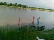
Kirtankhola
Kirtankhola (Bengali: কীর্তনখোলা) is
a river that
starts from Sayeshtabad in Barisal district
and ends into the Gajalia near Gabkhan khal (canal). The total length of the
river is about 160 kilometres (99 mi).

In ancient times, the Ganges used
to flow in three courses in Bengal, namely the Nalini, the Haldini and the
Pabni. The Pabni, meeting with the ancient Padma River joint
flow of which termed as the Sugandha, flowed through Madaripur south of
Faridpur, again renaming as the Andar Khan or the Arial Khan. The Arial Khan
branched out in several courses in Madaripur and
flowed through Barisal. Flowing forward and receiving various names, the Arial
Khan fell into the Bay of Bengal as the Haringhata.
In south of Madaripur, the Andar khal or the Arial Khan was
named as the Sugandha and was the greatest river of Bakla Chandradwip or the
South Bengal. In course of time, the deltaic branches of the Sugandha were
silted up and gradually disappeared creating various islands or chars in many parts
of the greater Barisal district. With the passage of time, the name Sugandha
was lost and the name Arial Khan became more prominent. One of the offshoots of
this Arial Khan flows eastward near Shayeshtabad and falls into the Bay of
Bengal after meeting with the meghna at Sahbazpur in bhola. Another offshoot of
Arial Khan flows south-southwest as the Kirtankhola up to Nalchity keeping the
Barisal town on its west bank. The further course of the river falls into
the Bay of Bengal receiving
various names at various places and finally as the Haringhata.
Hariabhanga River
Hariabhanga River (Bengali: হরিয়াভাঙ্গা
নদী)(also spelt Haribhanga) is a tidal estuarine river in and
around the Sundarbans in North
24 Parganas district in the Indian state of West Bengal, bordering
on Satkhira District of Bangladesh.

The Ichamati breaks
into several distributaries below Hingalganj the chief of which are the Raimangal, Bidya,
Jhilla, Kalindi and
Jamuna. It
follows the international boundary between India and Bangladesh. The New Moore Island is
located at the mouth of the Hariabhanga River.
Someshwari River
Someshwari River (also spelt Someswari) (Bengali: সোমেশ্বরী নদী), known
as Simsang River in the Indian state of Meghalaya, is a major river in the Garo
Hills of Meghalaya and Netrakona District of Bangladesh. It divides the Garo Hills into two parts.

Bangladesh

In Bangladesh it flows through the Susang-Durgapur and
other areas of Netrakona District till it flows into the Kangsha River. A branch of the river flows
towards Kalmakanda and
meets the Balia River. Another branch of the river flows into the haor areas
of Sunamganj District and
flows into the Surma River It
is one of Bangladesh's trans-boundary rivers.
Rupsa River
The Rupsha River is a river in
southwestern Bangladesh and a distributary of
the Ganges. Rupsha
is one of the most famous rivers of Bangladesh.
Description
It forms from the confluence of the Bhairab and Atrai rivers, and flows into the Pasur River.Its entire length is affected by
tides.

Rupsha
river, Khulna
It flows by the side of Khulna, and
connects to the Bay of Bengal through Poshur river at Mongla channel. Near
Chalna, it changes its name to Pasur River and flows into the Bay of
Bengal.
A significant number of fisheries, dockyards, shipyards and
factories are situated on the bank of this river. A significant number of
families depend on catching fish in the river. There is a bridge over the river
named Khan Jahan Ali Bridge. This bridge connects Khulna and Bagerhat Districts.
Tangon River
Tangon River (also known as Tongon River) (Bengali: টাংগন নদী) is a
river passing through the Indian state of West
Bengal and Bangladesh. It is
tributary of Punarbhaba River.
It was named after Tankonath, zamindar of Ranisankail in Thakurgaon District.

After originating in West Bengal, it passes through Panchagarh District, Pirganj in Rangpur
District, Bochaganj and Biral in Dinajpur
District in Bangladesh before it flows through Kushmandi and Bansihari community development blocks
of Dakshin Dinajpur
district in West Bengal. There is also a dam constructed on
Tangan river near boda town, 26'11'32"N 88'28'02" E.
It re-enters Bangladesh and meets Punarbhava River near Rohanpur
in Naogaon District.
Barrage
In 1989, a barrage was
built across the river 10 kilometres (6 mi) west of Boda in Panchagarh District.
Great job.
ReplyDeleteBangladesh's rivers are not just vital lifelines for agriculture and transportation, but they also shape the culture and history of the region. It's fascinating how rivers like the Padma, Jamuna, and Meghna connect so many lives. If you're someone who appreciates natural beauty and flowing landscapes, a trip to the hill stations of Darjeeling might also inspire you—check out some great travel options here: https://northbengaltourism.com/darjeeling-tour-packages/
ReplyDelete